
CND 2009/02/26 cuesta-de-los-ratones-pradico
Author

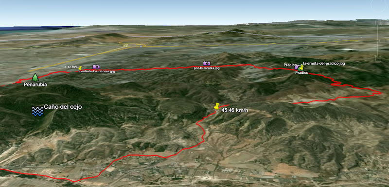
Trail stats
- Distance
- 22.76 mi
- Elevation gain
- 1,706 ft
- Technical difficulty
- Moderate
- Elevation loss
- 1,690 ft
- Max elevation
- 2,508 ft
- TrailRank
- 23
- Min elevation
- 1,054 ft
- Trail type
- One Way
- Time
- 2 hours 51 minutes
- Coordinates
- 1732
- Uploaded
- February 27, 2009
- Recorded
- February 2009
near Lorca, Región de Murcia (España)
Viewed 2327 times, downloaded 40 times
Itinerary description
Descripción y fotos de la ruta en:
http://ciclismonuestrodeporte.blogspot.com/2009/02/cuesta-de-los-ratones-pradico.html

Visita nuestra web: http://ciclismo.nuestrodeporte.es
http://ciclismonuestrodeporte.blogspot.com/2009/02/cuesta-de-los-ratones-pradico.html
Visita nuestra web: http://ciclismo.nuestrodeporte.es

You can add a comment or review this trail
Comments