
Turda Barranco Cheile Turzii
Trail photos


Author

Trail stats
- Distance
- 3.56 mi
- Elevation gain
- 138 ft
- Technical difficulty
- Easy
- Elevation loss
- 138 ft
- Max elevation
- 1,450 ft
- TrailRank
-
92
 4.9
4.9
- Min elevation
- 1,324 ft
- Trail type
- Loop
- Time
- 2 hours 49 minutes
- Coordinates
- 465
- Uploaded
- August 15, 2016
- Recorded
- July 2016
near Cheia, Cluj (România)
Viewed 1644 times, downloaded 51 times
Trail photos
Itinerary description
A small walk, through a beautiful corner inside this Barranco de Cheile Turzii. Next to the city of Turda, famous for its salt mines.

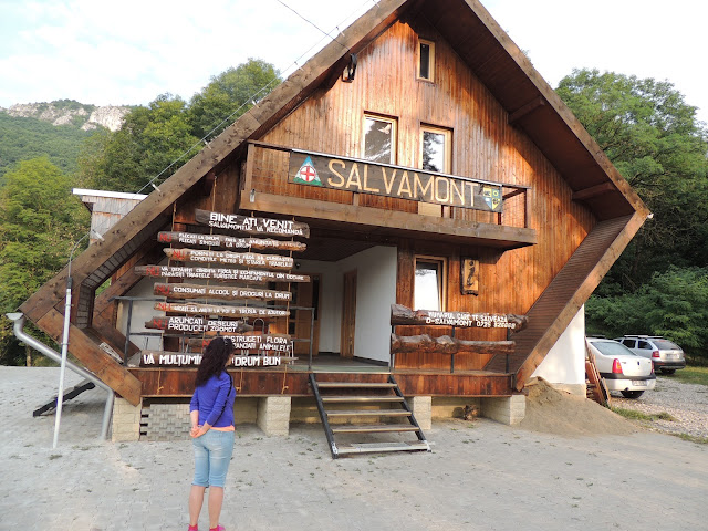
As we go down towards the beginning of the route, we see the great gap that we will have to travel. There is a small parking lot, where we see some tents. There is a fountain, where a small trickle of water falls. We cross by a bridge towards the house of Salvamento de Montaña, where we see a series of posters of the paths that can be made by this beautiful environment.
We are going to take a path to the right, marked by symbols of red circles on a white background. Which runs through the ravine from one part to the other.

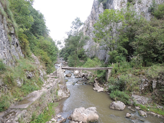
We reach a bridge, this same place is a crossroads. We are going to continue straight ahead and we will not cross the bridge at the moment. We cross this bridge on the way back, to go back another way. The path leads us into a beautiful riverbank forest.
Beside us the high walls that close this ravine. The river runs by our side, now to our right. But we are going to go from one bank to another on several occasions by wooden footbridges.
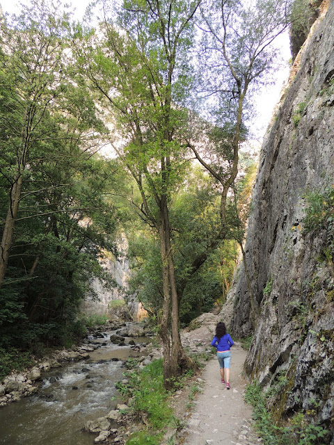
The walk is comfortable, in some area is somewhat narrow and there are ropes to the wall, to help your step. We find a curious stone with boots buried under it. And a small spring, which comes down from the rocks.

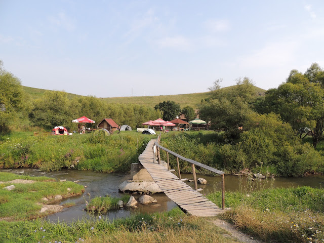
At the end of the ravine, we go out to meadows and the river rears. We find a campsite, very good looking. We stopped and had lunch for a while.
Once rested, we turn around to go back the same way we came. With the exception, that when we reached the junction of paths at the beginning, where there was a bridge that we did not cross. Now we are going to do it, to go back to another place at the beginning of the route. Although under my opinion it is much more beautiful, the return do it by the same way one way. I wish you enjoy the route.
Transportation : Private vehicle.
Recommended time : Spring, Summer, Autumn, Winter.
Statistics :
Level of difficulty: Very easy
Distance: 6.5 km
Slope + 18 meters Slope - 26 meters
Total time: 2h 49 '
Moving time: 2h 21 '
Time stopped: 27 '
Average total speed: 2.33 km / h
Average speed in movement: 2,78 km / h
Total average pace per km: 25:48 min / km
Average pace in movement per km: 17:28 min / km
IBP Index Index: 19 IBP INDEX Report


As we go down towards the beginning of the route, we see the great gap that we will have to travel. There is a small parking lot, where we see some tents. There is a fountain, where a small trickle of water falls. We cross by a bridge towards the house of Salvamento de Montaña, where we see a series of posters of the paths that can be made by this beautiful environment.

We are going to take a path to the right, marked by symbols of red circles on a white background. Which runs through the ravine from one part to the other.

We reach a bridge, this same place is a crossroads. We are going to continue straight ahead and we will not cross the bridge at the moment. We cross this bridge on the way back, to go back another way. The path leads us into a beautiful riverbank forest.
Beside us the high walls that close this ravine. The river runs by our side, now to our right. But we are going to go from one bank to another on several occasions by wooden footbridges.


The walk is comfortable, in some area is somewhat narrow and there are ropes to the wall, to help your step. We find a curious stone with boots buried under it. And a small spring, which comes down from the rocks.

At the end of the ravine, we go out to meadows and the river rears. We find a campsite, very good looking. We stopped and had lunch for a while.

Once rested, we turn around to go back the same way we came. With the exception, that when we reached the junction of paths at the beginning, where there was a bridge that we did not cross. Now we are going to do it, to go back to another place at the beginning of the route. Although under my opinion it is much more beautiful, the return do it by the same way one way. I wish you enjoy the route.
Transportation : Private vehicle.
Recommended time : Spring, Summer, Autumn, Winter.
Statistics :
Level of difficulty: Very easy
Distance: 6.5 km
Slope + 18 meters Slope - 26 meters
Total time: 2h 49 '
Moving time: 2h 21 '
Time stopped: 27 '
Average total speed: 2.33 km / h
Average speed in movement: 2,78 km / h
Total average pace per km: 25:48 min / km
Average pace in movement per km: 17:28 min / km
IBP Index Index: 19 IBP INDEX Report

Waypoints
 Information point
 Campsite


 Fountain
 1,331 ft
Fuente 07:48:16

 Bridge


Comments (10)
You can add a comment or review this trail
I have followed this trail View more
Information
Easy to follow
Scenery
Easy
Una ruta sencilla, por un precioso Barranco.
Hola
En todas las partes del mundo hay sitios bonitos y andando es la mejor forma de encontrarlos
Es cierto Román, yo he descubierto que si caminas se observan mejor las cosas. Al ir más despacio te da tiempo a fijarte más. Carmelo y Román iros preparando que en breve si estais por los madriles salimos a algún sitio, un abrazo.
Un traseu bine cunoscut de transivaneni si nu numai. Un defileu frumos prin care trebuie sa treci de cateva ori pe poduri din lemn peste apa. La final am gasit camping-ul Cheile Turzii si ne-a placut foarte mult. Se recomanda intoarcerea pe acelasi traseu.
Ruta corta, pero con el encanto del desfiladero.
Frank es una precioso paseo.
Multumesc Lavilav
I have followed this trail verified View more
Information
Easy to follow
Scenery
Easy
La información que das está muy bien y la ruta es bonita y fácil de hacer.
Hola poti-poti, me alegro saber que te ha gustado la ruta. La verdad que es una preciosidad de lugar. Muchas gracias por tu comentario y valoración, saludos antonio.