
Oaxaca - MonteAlbán (MEX)
Trail photos


Author

Trail stats
- Distance
- 5.79 mi
- Elevation gain
- 472 ft
- Technical difficulty
- Easy
- Elevation loss
- 1,617 ft
- Max elevation
- 6,257 ft
- TrailRank
- 32
- Min elevation
- 6,257 ft
- Trail type
- One Way
- Coordinates
- 147
- Uploaded
- November 2, 2008
- Recorded
- November 2008
near Arrazola, Oaxaca (Mexico)
Viewed 6623 times, downloaded 75 times
Trail photos
Itinerary description
Monte Alban is located on a mountain 400 m above the Valley of Oaxaca, It was a ancient Zapotec-Mixtec civic-ceremonial center and it is estimated that only about 10% of the site has been uncovered but they have already found over 170 tombs, numerous ceremonial altars, stelae, pyramids, and palaces... From the top of the temple you can get a good view of the surrounding area from here. Monte Alban created a grandiose architectural landscape which, like that of Machu Picchu, represents a unique artistic achievement... READ MORE LEER MAS

Waypoints
 Photo
Photo
 0 ft
0 ft

Oaxaca
Oaxaca, Oaxaca, México
Patrimonio de la Humanidad
Cultural Haritage
- Patrimonio de la Humanidad
Cultural Haritage
Oaxaca, Oaxaca, México
Patrimonio de la Humanidad
Cultural Haritage
Patrimonio de la Humanidad
Cultural Haritage
 Waypoint
0 ft
Waypoint
0 ft
Central de Autobuses (Bus Station)
Central de Autobuses - Central de Autobuses Main Bus Station
Waypoint
0 ft
Hotel Mesón del Angel (Buses to Montes Alban)
Hotel Mesón del Angel - Hotel Mesón del Angel Here departs bus station to Monte Alban
Photo
0 ft

Monte Albán
Monte Albán
Patrimonio de la Humanidad
Cultural Heritage
Patrimonio de la Humanidad
Cultural Heritage
 -
- Monte Albán
Patrimonio de la Humanidad
Cultural Heritage
Patrimonio de la Humanidad
Cultural Heritage
Photo
0 ft
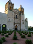
Cuilapan, Oaxaca
Cuilapan, Oaxaca - Cuilapan, Oaxaca
Comments (1)
You can add a comment or review this trail
CUANDO PEDALEAN PARA ESA RUTA