
ESLOVÈNIA Carretera panoràmica de Solčava, vall de Logarska i cascada de Rinka
Trail photos


Author

Trail stats
- Distance
- 30.16 mi
- Elevation gain
- 4,501 ft
- Technical difficulty
- Easy
- Elevation loss
- 4,501 ft
- Max elevation
- 4,414 ft
- TrailRank
- 57
- Min elevation
- 2,080 ft
- Trail type
- Loop
- Time
- 6 hours 19 minutes
- Coordinates
- 5877
- Uploaded
- July 1, 2020
- Recorded
- June 2019
near Solčava, Solčava (Slovenija)
Viewed 589 times, downloaded 33 times
Trail photos
Itinerary description
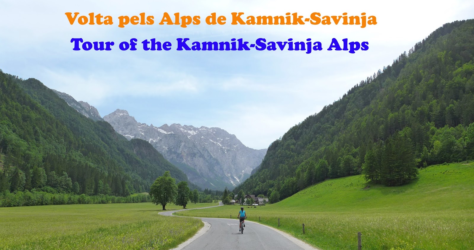
Spectacular route through the upper Savinja Valley and the impressive Logar Valley, through what are known as the Kamnik-Savinja Alps, located in the northernmost part of Slovenia, bordering the Austrian border.
It is a vault without technical difficulties, by secondary roads, asphalted tracks and dirt tracks, all of them of very good rolling and with unbeatable views of many of the limestone peaks of this sector of the Alps of Kamnik-Savinja. We will start from the village of Solčava and cycle along what is known as the panoramic road of Solčava, crossing picturesque Slovenian rural landscapes, with traditional wooden farms (many of them also offer rural accommodation) and with impressive limestone peaks as a backdrop. background. Later we will reach the same Austrian border where we will break through a dirt track that will make us lose the difference between leafy and mature fir forests. To round off this panoramic route, we will enter the deep valley of Logar (Logarska dolina), the longest glacial valley in all the Kamnic-Savinja Alps. Its U-shape can be clearly seen shaped by the long tongue of ice that descended from glacial circuses about 10,000 years ago. We will gain a gentle gradient, always guarded by steep limestone peaks of more than 2,000 meters, until we reach the end of the track, where we leave the bikes in a bar-restaurant to walk about 15 minutes along a steep path that will take us to the spectacular Rinka waterfall, a waterfall about 100 meters high proclaimed a natural monument of Slovenia. Then we return on foot where we came to the bar where we have the bikes and undo all the climb we had done through the valley of Logar until we reach the beginning again, at which point we continue along the valley of the river Savinja until we reach back to Solčava, beginning and end of this picturesque route.
Waypoints
 Photo
Photo
 4,100 ft


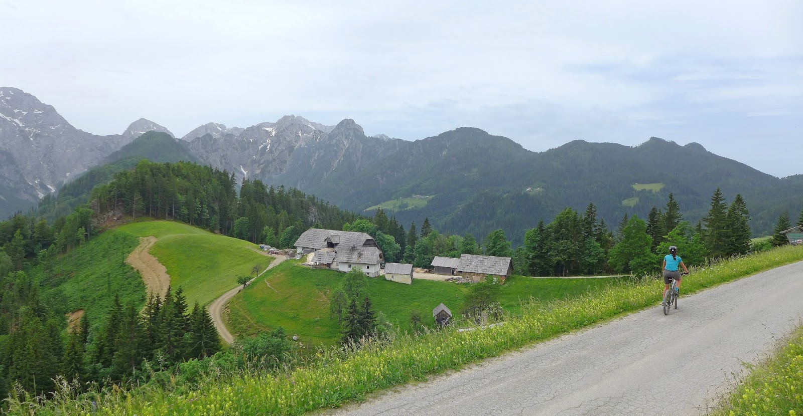
Solčava panoramic road
La carretera panoràmica de Solčava recorres l'alta vall de Savinja a mitja vessant, travessant bells paisatges rurals d'aquesta regió dels Alps eslovens, a tocar de la frontera austríaca i esquitxada de granges tradicionals.
 Religious site
4,262 ft
Religious site
4,262 ft


Podolševa
Podolševa és un assentament de l'església de l'Esperit Sant i algunes granges que també ofereixen allotjament turístic, situat a la mateixa carretera panoràmica de Solčava.
 Waypoint
4,405 ft
Waypoint
4,405 ft

Frontera austríaca
Arribarem ben bé fins a la mateixa frontera d'Eslovènia amb Àustria, punt en que prendrem una pista a l'esquerra.
Photo
4,207 ft

Cabana de fusta
Una de les cabanes de fusta tradicionals eslovenes que trobarem durant aquest itinerari
Waypoint
3,903 ft


Granja turística
Una de les moltes granges tradicionals eslovenes que complementen els seus ingressos oferint allotjament turístic
Photo
2,430 ft


Logarska dolina (Vall de Logar)
La vall de Logar (Logarska dolina) és la vall glacial més llarga de tots els Alps de Savinja. Es pot apreciar clarament la seva forma de U modelada per la llarga llengua de glaç que descendia dels circs glacial fa uns 10.000 anys.
 Provisioning
3,462 ft
Provisioning
3,462 ft

Bar-Restaurant
Just al punt on s'acaba la pista hi ha un bar-restaurant on ens van vigilar les bicicletes mentre vam fer el recorregut a peu fins a l'espectacular cascada de Rinka.
 Waterfall
3,923 ft
Waterfall
3,923 ft


Cascada Rinka
About 100 meters high is the longest waterfall of 20 in the Logar Valley. Declared a national monument of Slovenia, it has a spectacular wooden viewpoint.
Religious site
2,154 ft

Església de Solčava
Vam començar i acabar la ruta des de l'aparcament que hi ha al costat de l'església del poble de Solcava.
You can add a comment or review this trail
Comments