
ESLOVÈNIA Bled i valls de Radovna i de Krma
Trail photos


Author

Trail stats
- Distance
- 30.13 mi
- Elevation gain
- 2,234 ft
- Technical difficulty
- Easy
- Elevation loss
- 2,234 ft
- Max elevation
- 3,148 ft
- TrailRank
- 60
- Min elevation
- 1,539 ft
- Trail type
- Loop
- Time
- 6 hours 35 minutes
- Coordinates
- 9425
- Uploaded
- June 24, 2020
- Recorded
- June 2019
near Poljšica pri Gorjah, Gorje (Slovenija)
Viewed 684 times, downloaded 30 times
Trail photos
Itinerary description
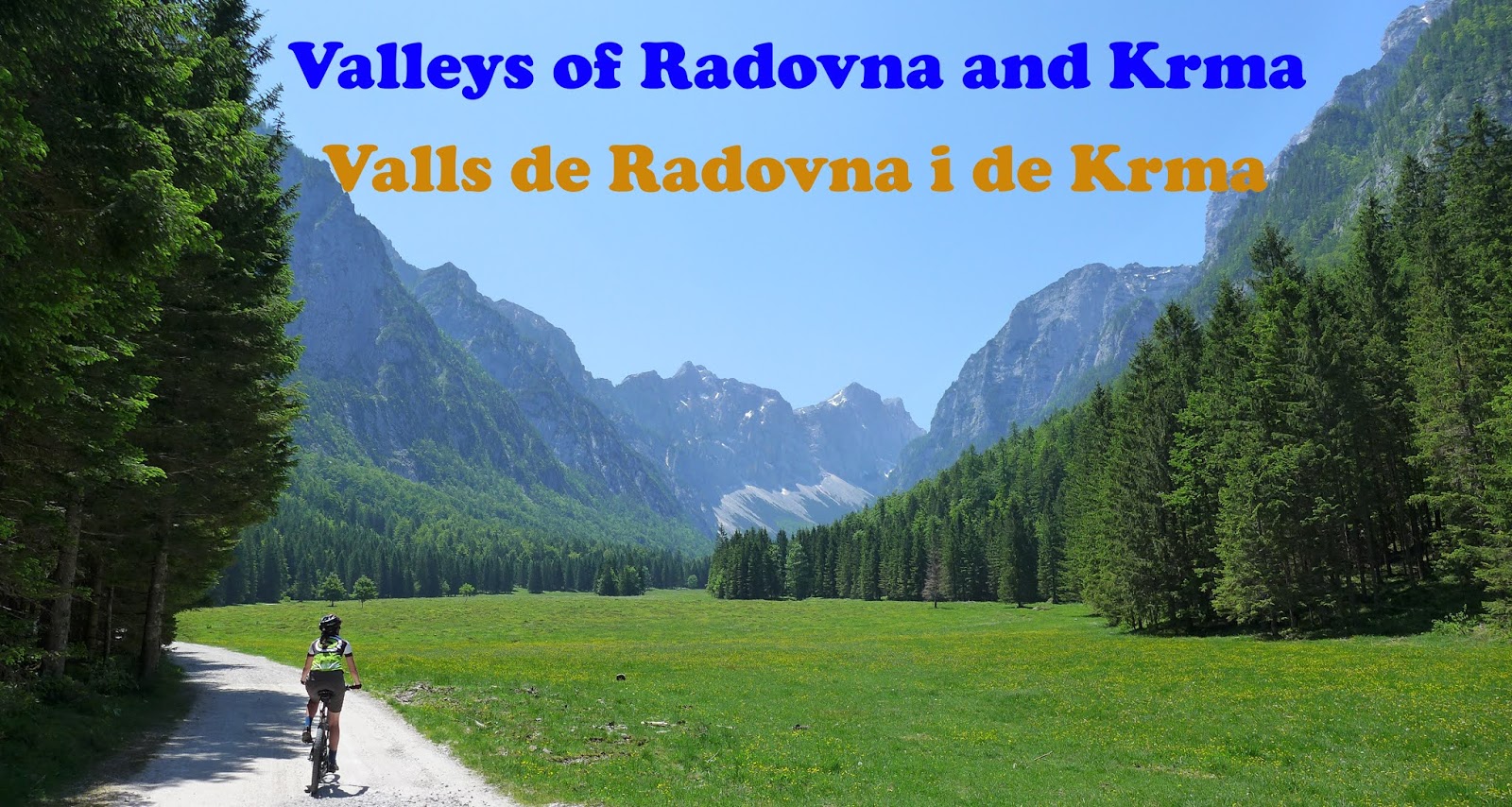
Itinerary without any technical difficulties that passes almost entirely on paved tracks (except for a final section by a track in poor condition but that can be avoided) and that goes through very picturesque and emblematic places of this sector of the Slovenian Julian Alps. We leave the tourist town of Bled, known for the famous picture of its lake, with an island where there is a picturesque church and a spectacular castle on the shores of the lake. We drive away from Bled on secondary roads that cross the Slovenian countryside until we reach the river Radovna, from which we will gently ascend its beautiful valley by a very good rolling secondary road. Then we leave the valley of the river Radovna to ascend the valley of one of its tributaries, the valley of the river Krma, also very good rolling and even more spectacular and picturesque, as it is very excavated and shaped by the ancient Quaternary glaciers from the imposing tops of the head. After climbing the Krma valley in the middle of postcard-worthy bucolic prints, the trail ends and we return along the same path, stopping before lunch at the Kovinarska refuge, located in the heart of this spectacular valley. When we are close enough to Bled, we wander a bit along slightly steep tracks of a wooded and mountainous area close to the city to vary a bit and not return by the same place. Some stretches of these tracks are quite abandoned and in poor condition, so those who do not want to complicate life better just return to the same place. During the final stretch we pass by the shore of Lake Bled and take the opportunity to bathe and cool off in this emblematic place.
Waypoints
 River
River
 Mountain hut
 Photo
Photo
 2,875 ft


Vall de Krma
Espectacular vall d'origen glacial situada al cor del Parc Nacional de Triglav, als Alps Julians eslovens
 Waypoint
3,140 ft
Waypoint
3,140 ft

Casa forestal
Petit refugi tancat que hi ha al final de la pista que s'endinsa per la vall de Krma


 Panorama
2,118 ft
Panorama
2,118 ft


Campinya eslovena
Pels voltants de Bled tindrem boniques estampes de la campinya eslovena rodejada de les imponents muntanyes dels Alps Julians.
 Lake
2,254 ft
Lake
2,254 ft

Vistes del Llac Bled
Des d'aquest podem gaudir d'espectaculars vistes sobre el llac Bled
Lake
1,593 ft


Llac Bled
Passing by this picturesque lake we take the opportunity to swim and cool off a bit.
You can add a comment or review this trail
Comments