
CA - Kampot surrounds and Kep by motorbike
Trail photos


Author

Trail stats
- Distance
- 53.14 mi
- Elevation gain
- 2,044 ft
- Technical difficulty
- Easy
- Elevation loss
- 2,215 ft
- Max elevation
- 231 ft
- TrailRank
- 36
- Min elevation
- 231 ft
- Trail type
- Loop
- Time
- 6 hours 57 minutes
- Coordinates
- 1531
- Uploaded
- June 19, 2010
- Recorded
- June 2010
near Phumĭ Kâmpóng Kândal, Kâmpôt (Cambodia)
Viewed 5089 times, downloaded 30 times
Trail photos
Itinerary description
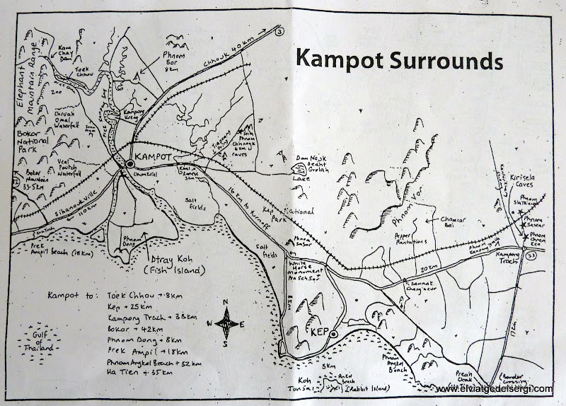
Map
If you want this review in english, here is the English version
We went to visit a caves (we couldn't find them...) , a lake, Kep city (so much turistic for me...), a beach in a fishing village, one budis temple and the peeper plantations.
Extret del elviatgedelsergi.com Versió Catalana
Vam anar a visitar unes coves que no vam trovar, un llac, la ciutat de Kep (molt turística pel meu gust...), una platja en un poble de pescadors, un temple budista i les plantacions de pebre negre.

Waypoints
 Photo
Photo 0 ft
0 ft

 Lake
Lake

 Waypoint
 Panorama

You can add a comment or review this trail
Comments