
Poiana Tapului Cascada de Urlatoarea
Trail photos


Author

Trail stats
- Distance
- 2.38 mi
- Elevation gain
- 699 ft
- Technical difficulty
- Easy
- Elevation loss
- 699 ft
- Max elevation
- 3,576 ft
- TrailRank
-
70
 5
5
- Min elevation
- 2,899 ft
- Trail type
- Loop
- Time
- 2 hours 12 minutes
- Coordinates
- 314
- Uploaded
- September 18, 2017
- Recorded
- August 2017
near Poiana Țapului, Județul Prahova (România)
Viewed 6779 times, downloaded 222 times
Trail photos
Itinerary description
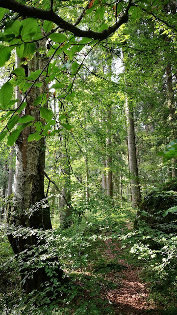
A short walk, to get closer to see one of the most beautiful waterfalls in the Bucegi Mountains, the Urlatoarea waterfall.
It is located in the middle of the forest. The path is perfectly marked by blue circle marks. It is also possible to go from the town of Busteni. Both trails join at the waterfall.

We arrive at the town and take the street with the same name as the waterfall. At the end of it we will see a car park where we can leave the car. We see an informative sign and the path to follow. The forest surrounds us with its beautiful shapes and colors.

It is a quiet path in constant ascent, but it gets along well. In 1.7 km we have reached the foot of the waterfall and we see how the Busteni path marked by red circles comes from the right. I traveled part of this route the day I did this Busteni to Cabana Babele route through Jepii Mare.

We stayed a good while in the place because it deserves it. Now it's time to return and we will do it through the same place we came from. On the way back we met someone who pointed out a nice place we could visit. It was about the canyon of the seven stairs so we went to that place and we did this route.....
Video of the route
Transportation Private vehicle.
Recommended season Spring, Summer, Autumn, Winter.
statistics
Difficulty level: Easy
Distance: 3.8km
Unevenness + 221 meters Unevenness - 185 meters
Total time: 2h 12'
Moving time: 1h 14'
Standing time: 57'
Overall average speed: 1.76 km/h
Average moving speed: 3.13 km/h
Total average pace per km: 34:30 min/km
Average moving pace per km: 17:33 min/km
IBP Index: 29 Report
Other routes in the area
It is located in the middle of the forest. The path is perfectly marked by blue circle marks. It is also possible to go from the town of Busteni. Both trails join at the waterfall.

We arrive at the town and take the street with the same name as the waterfall. At the end of it we will see a car park where we can leave the car. We see an informative sign and the path to follow. The forest surrounds us with its beautiful shapes and colors.


It is a quiet path in constant ascent, but it gets along well. In 1.7 km we have reached the foot of the waterfall and we see how the Busteni path marked by red circles comes from the right. I traveled part of this route the day I did this Busteni to Cabana Babele route through Jepii Mare.

We stayed a good while in the place because it deserves it. Now it's time to return and we will do it through the same place we came from. On the way back we met someone who pointed out a nice place we could visit. It was about the canyon of the seven stairs so we went to that place and we did this route.....
Video of the route
Transportation Private vehicle.
Recommended season Spring, Summer, Autumn, Winter.
statistics
Difficulty level: Easy
Distance: 3.8km
Unevenness + 221 meters Unevenness - 185 meters
Total time: 2h 12'
Moving time: 1h 14'
Standing time: 57'
Overall average speed: 1.76 km/h
Average moving speed: 3.13 km/h
Total average pace per km: 34:30 min/km
Average moving pace per km: 17:33 min/km
IBP Index: 29 Report
Other routes in the area
Waypoints
 Car park


 Waterfall


 Intersection
 0 ft
0 ft
Sendero desde Sinaia a Cascadas 11:27:05
Comments (7)
You can add a comment or review this trail
I have followed this trail View more
Information
Easy to follow
Scenery
Easy
Una ruta sencilla por los maravillosos bosques de Rumania. La cascada Urlatoarea ( traduciendo como Cascada Gritona - por su sonido fuerte ) es una atracción turistica natural que merece la pena subir a verla. Y la senda hasta alli es preciosa. Recomendable para familias con niños también.
Cierto lavilav, esta ruta es un bello paseo por estos hermosos bosques de Bucegi.
Encantado que disfrutaras, los parajes espectaculares. Un abrazo
I have followed this trail View more
Information
Easy to follow
Scenery
Easy
El paisaje muy bonito, ruta sin dificultad. La cascada preciosa
Hola vmindaeanu, es una zona con lugares con mucho encanto. No dejo de descubrir sitios, cada vez que ando por los Carpatos, como esta bella cascada. Ya tengo ganas de volver, saludos antonio.
I have followed this trail verified View more
Information
Easy to follow
Scenery
Easy
Nice and short hike suitable for beginners.
The forest is beautiful and very quiet (we didn’t come across too many hikers).
The path is easy to follow (blue marks on the trees) and there is no climbing, just walking (admitted, it is uphill :-).
Hola mams.cdm , me alegro que te haya gustado, gracias por tu comentario y valoración, saludos antonio.