
New Zealand - Okere Falls
Trail photos


Author

Trail stats
- Distance
- 1.52 mi
- Elevation gain
- 240 ft
- Technical difficulty
- Moderate
- Elevation loss
- 240 ft
- Max elevation
- 1,280 ft
- TrailRank
- 32
- Min elevation
- 1,123 ft
- Trail type
- Loop
- Time
- one hour 12 minutes
- Coordinates
- 70
- Uploaded
- January 1, 2016
- Recorded
- November 2015
near Okere Falls, Bay of Plenty (New Zealand)
Viewed 682 times, downloaded 27 times
Trail photos
Itinerary description
Link to the blog post - Link to the blog page
Track Description / Characteristics of the Route:
Distance / Distance: 2.45 km
Elevation Gain / Ascent: 70m
Max / Min Altitude: 390m / 342m
Difficulty / Difficulty: Easy / Easy
Alpine Grade: SD (Without difficulty)
Activity: Hiking / Hiking
Recommended Cartography / Recommended Cartography:

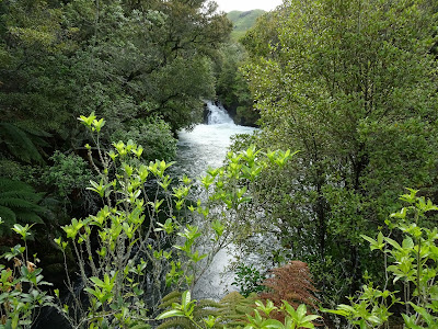
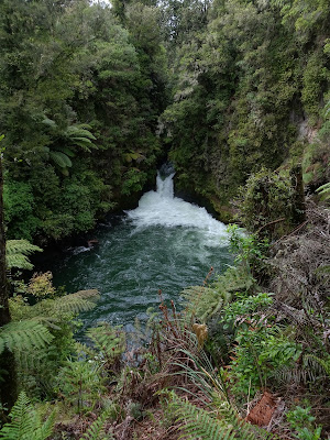
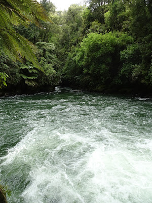
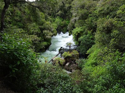
In the Bay of Plenty, near Lake Rotorua, we find the Okere waterfalls. On the Kaituna River, on its way to the Pacific Ocean, this natural sinkhole of the lake has formed a wonderful environment for kajaking and rafting. For those who do not practice these sports, there is also a conditioned road along the first part of the river that allows us to discover the beauty of the place. If you are interested in rafting activities in the area, visit the DOC website for the Okere Falls in order to find commercial operators working in the area.
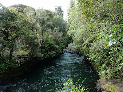
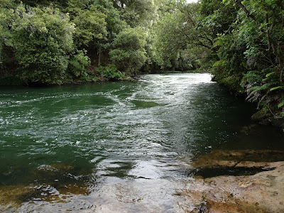
The road along the river is well marked, and we have good views of the different waterfalls.
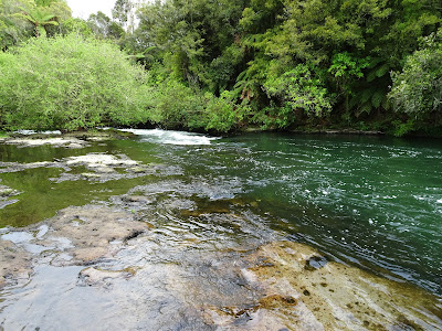
Along the way we see several entry and exit points for kajaking and rafting.
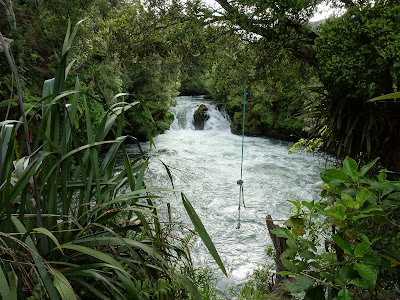
At the end of the road, near the second parking, there is a viewpoint and a bridge that crosses the river. Be careful if you go down to the river level, since the rock is quite slippery and the water current is very strong.
On the way back, we visit the ruins of an old hydroelectric station and a cave that exists in the waterfall. Apparently, this place was used by the native population as a refuge in times of war, given its inaccessibility.
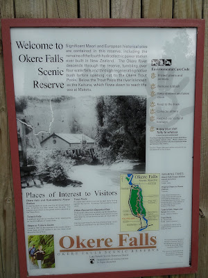
Summary:
- Easy 1 hour route that allows us to know the first part of the Kaituna River. Always walk along the conditioned path, with the strong current of water, falling into the river can have unintended consequences.
Track Description / Characteristics of the Route:
Distance / Distance: 2.45 km
Elevation Gain / Ascent: 70m
Max / Min Altitude: 390m / 342m
Difficulty / Difficulty: Easy / Easy
Alpine Grade: SD (Without difficulty)
Activity: Hiking / Hiking
Recommended Cartography / Recommended Cartography:
In the Bay of Plenty, near Lake Rotorua, we find the Okere waterfalls. On the Kaituna River, on its way to the Pacific Ocean, this natural sinkhole of the lake has formed a wonderful environment for kajaking and rafting. For those who do not practice these sports, there is also a conditioned road along the first part of the river that allows us to discover the beauty of the place. If you are interested in rafting activities in the area, visit the DOC website for the Okere Falls in order to find commercial operators working in the area.
The road along the river is well marked, and we have good views of the different waterfalls.
Along the way we see several entry and exit points for kajaking and rafting.
At the end of the road, near the second parking, there is a viewpoint and a bridge that crosses the river. Be careful if you go down to the river level, since the rock is quite slippery and the water current is very strong.
On the way back, we visit the ruins of an old hydroelectric station and a cave that exists in the waterfall. Apparently, this place was used by the native population as a refuge in times of war, given its inaccessibility.
Summary:
- Easy 1 hour route that allows us to know the first part of the Kaituna River. Always walk along the conditioned path, with the strong current of water, falling into the river can have unintended consequences.
Waypoints
 Cave
Cave 0 ft
0 ft Photo
Photo Car park
You can add a comment or review this trail
Comments