
New Zealand - Mount Robert - Lake Rotoiti
Trail photos


Author

Trail stats
- Distance
- 5.43 mi
- Elevation gain
- 1,959 ft
- Technical difficulty
- Moderate
- Elevation loss
- 1,959 ft
- Max elevation
- 4,708 ft
- TrailRank
- 57
- Min elevation
- 2,771 ft
- Trail type
- Loop
- Time
- 2 hours 43 minutes
- Coordinates
- 1026
- Uploaded
- December 28, 2015
- Recorded
- November 2015
near Saint Arnaud, Tasman (New Zealand)
Viewed 1273 times, downloaded 69 times
Trail photos
Itinerary description
Link to the blog post - Link to the blog page
Track Description / Characteristics of the Route:
Distance / Distance: 8.75 km
Elevation Gain / Ascent: 580m
Max / Min Altitude: 1435m / 845m
Difficulty / Difficulty: Easy / Easy
Alpine Grade: SD (Without difficulty)
Alpine Grade: SD (Without difficulty)
Activity: Hiking / Hiking
Recommended Cartography / Recommended Cartography:
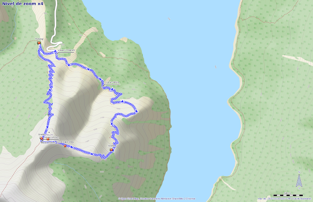
The Nelson Lakes National Park is located in the northern part of the South Island of New Zealand. It includes two lakes, Rotoiti and Rotoroa, two mountain ranges, Saint Arnadu and Monte Robert. The area is populated by dense forests and small, rounded mountains, making the region a popular tourist destination. The area is well known for the variety of activities we can do in it, such as fishing, skiing, mountaineering, kayaking. On our visit to the Nelson Lakes, we climbed Mount Robert, one of the recommended climbs by the DOC in the area.
Mount Robert rises above Lake Rotoiti. Most of its slopes are covered by dense New Zealand beech forests, until we reach the line where the forest ends, where the ground is covered by a tapestry of green grass. Starting from the upper parking lot, the climb was made by the Pinchgut road, and the descent using Paddy's road. On the way we find three shelters quite well preserved (one of them is private, only for the use of the members of a ski club).
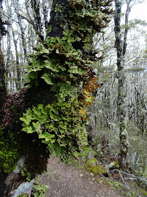
Starting in the parking above, we must first ascend through a forest of New Zealand beech trees.
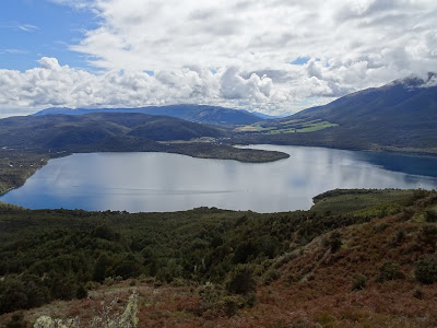
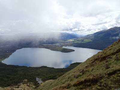
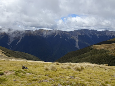
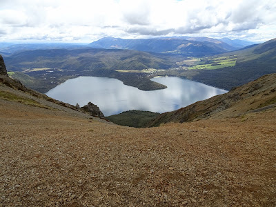
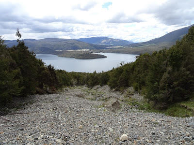
Then we reach the forest line, where we already have spectacular views of Lake Rotoiti and the green valleys that surround it.
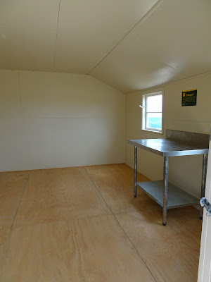
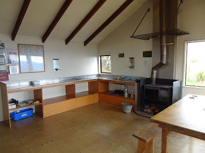
Near the summit we find this metal shelter, in perfect condition, where you can cook and spend the night.
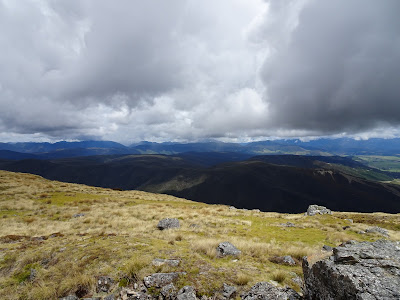
The views from the top are impressive, not only can we see the lake, but all the valleys surrounding Mount Robert are beautiful.
Idyllic landscapes
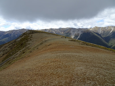
At the summit we can decide if we continue along the ridge to the summit of Mount Julius, or use Paddy's track to return to our starting point. As we did not have much time we went back for Paddy's track.
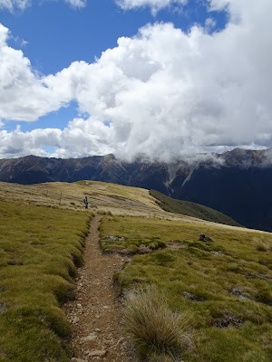
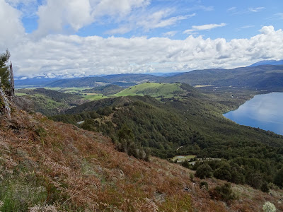
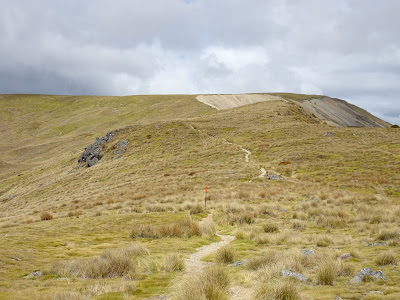
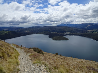
Walking along the wide ridge we have a nice perspective of the Lake seen from above.
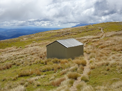
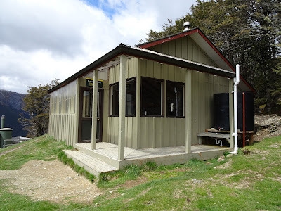
The Bushline refuge is also very well preserved, open all year round, it is located in an idyllic place to spend the night.
The way back uses the north side of the mountain, facing the lake, to descend towards the parking lot.
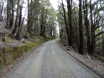
After a few kilometers we are back on the unpaved road that will take us to the parking lot from where we started the activity.
Summary:
- Easy and beautiful excursion in the Nelson Lakes National Park. Wonderful views, very low technical difficulty, and there are three cabins where we can take refuge in case of bad weather, or that we have to spend the night.
- There are toilets in the parking lot, but I have not seen any source or point to drink water in the whole route. The unpaved road to get to the parking lot above, although a little long, was in perfect condition at least at the time of doing this activity.
Track Description / Characteristics of the Route:
Distance / Distance: 8.75 km
Elevation Gain / Ascent: 580m
Max / Min Altitude: 1435m / 845m
Difficulty / Difficulty: Easy / Easy
Alpine Grade: SD (Without difficulty)
Alpine Grade: SD (Without difficulty)
Activity: Hiking / Hiking
Recommended Cartography / Recommended Cartography:
The Nelson Lakes National Park is located in the northern part of the South Island of New Zealand. It includes two lakes, Rotoiti and Rotoroa, two mountain ranges, Saint Arnadu and Monte Robert. The area is populated by dense forests and small, rounded mountains, making the region a popular tourist destination. The area is well known for the variety of activities we can do in it, such as fishing, skiing, mountaineering, kayaking. On our visit to the Nelson Lakes, we climbed Mount Robert, one of the recommended climbs by the DOC in the area.
Mount Robert rises above Lake Rotoiti. Most of its slopes are covered by dense New Zealand beech forests, until we reach the line where the forest ends, where the ground is covered by a tapestry of green grass. Starting from the upper parking lot, the climb was made by the Pinchgut road, and the descent using Paddy's road. On the way we find three shelters quite well preserved (one of them is private, only for the use of the members of a ski club).
Starting in the parking above, we must first ascend through a forest of New Zealand beech trees.
Then we reach the forest line, where we already have spectacular views of Lake Rotoiti and the green valleys that surround it.
Near the summit we find this metal shelter, in perfect condition, where you can cook and spend the night.
The views from the top are impressive, not only can we see the lake, but all the valleys surrounding Mount Robert are beautiful.
Idyllic landscapes
At the summit we can decide if we continue along the ridge to the summit of Mount Julius, or use Paddy's track to return to our starting point. As we did not have much time we went back for Paddy's track.
Walking along the wide ridge we have a nice perspective of the Lake seen from above.
The Bushline refuge is also very well preserved, open all year round, it is located in an idyllic place to spend the night.
The way back uses the north side of the mountain, facing the lake, to descend towards the parking lot.
After a few kilometers we are back on the unpaved road that will take us to the parking lot from where we started the activity.
Summary:
- Easy and beautiful excursion in the Nelson Lakes National Park. Wonderful views, very low technical difficulty, and there are three cabins where we can take refuge in case of bad weather, or that we have to spend the night.
- There are toilets in the parking lot, but I have not seen any source or point to drink water in the whole route. The unpaved road to get to the parking lot above, although a little long, was in perfect condition at least at the time of doing this activity.

Waypoints
 Photo
Photo 0 ft
0 ft
 Summit


 Car park
 Wilderness hut


You can add a comment or review this trail
Comments