
New Zealand - Fiordland - Lake Marian
Trail photos


Author

Trail stats
- Distance
- 1.78 mi
- Elevation gain
- 1,293 ft
- Technical difficulty
- Moderate
- Elevation loss
- 20 ft
- Max elevation
- 2,464 ft
- TrailRank
- 35
- Min elevation
- 1,188 ft
- Trail type
- One Way
- Time
- 56 minutes
- Coordinates
- 58
- Uploaded
- December 28, 2015
- Recorded
- November 2015
near Kinloch, Otago (New Zealand)
Viewed 1435 times, downloaded 61 times
Trail photos
Itinerary description
Link to the blog post - Link to the blog page
Track Description / Characteristics of the Route:
Distance / Distance: 2.87km (one way)
Elevation Gain / Ascent: 391m
Max / Min Altitude: 751m / 362m
Difficulty / Difficulty: Medium / Medium
Alpine Grade: SD (Without difficulty)
Activity: Hiking / Hiking
Recommended Cartography / Recommended Cartography:
On the way to the Fjord region, on the southern island, on the road from Te-Anau to Milford we can find a lot of wonderful routes that are made in a few hours. A few kilometers before passing the Tunnel of Homer, we stopped to make the route of Lake Marian, a route of one hour (one way) that takes us to a boxed glacial lake carved by the ice between two granitic walls.
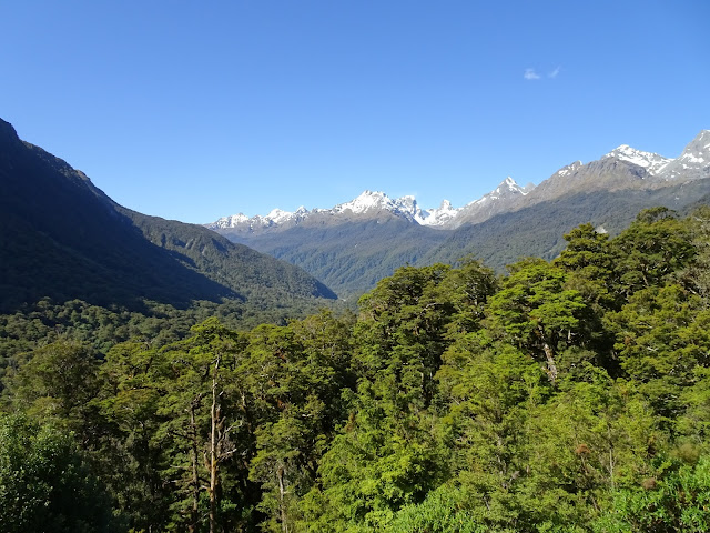
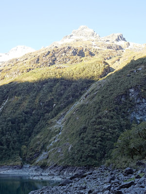
The region of the Fjords is a labyrinth of glacial valleys and low mountains, carved by ice for thousands of years, with dense native forests. Wherever you are, you have a beautiful 360 degree view of this great landscape. Threatened bird species such as Kea find in these forests a refuge from their predators.
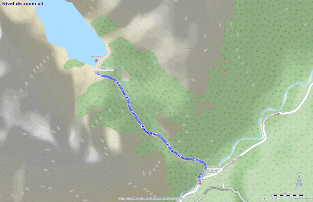
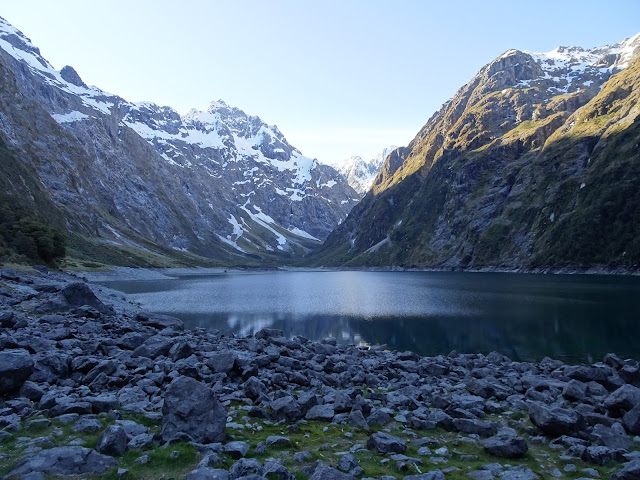
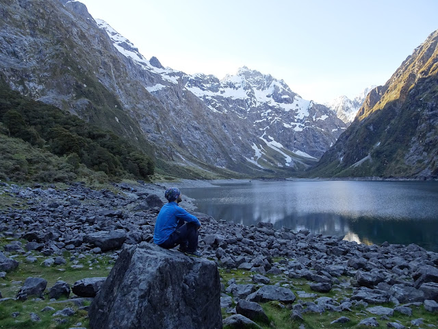
From the parking we have an hour to get to Lake Marian. The terrain is not very technical, but after rainy days it can be slippery and muddy. It should also be noted that, although it is marked, there are some sections that can be a little confusing, so you have to be attentive all the time to the road markings. As the intuition tells us, the lake is located inside the glacial valley hung in a U-shape, as the image below shows.

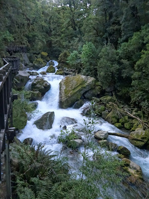
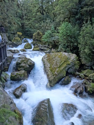
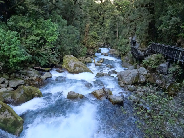
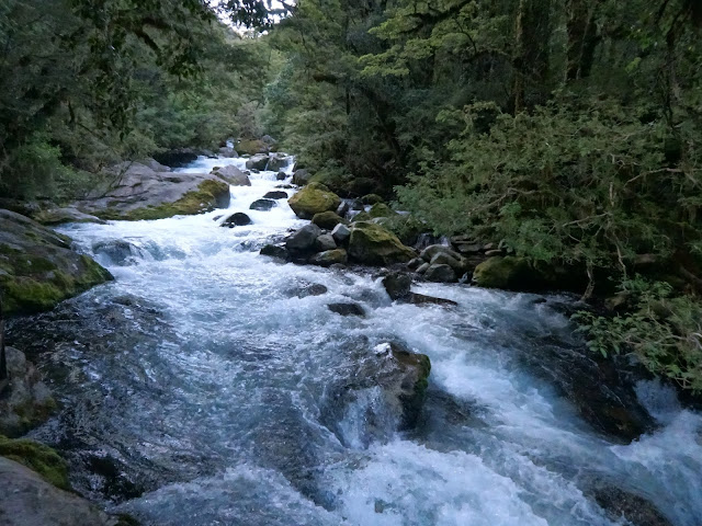
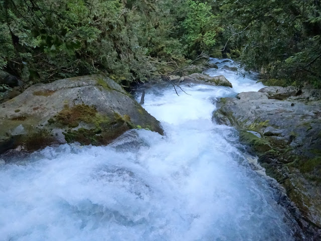
The first meters of the route are equipped with wooden walkways so that tourists can see the stream and the waterfalls that form.
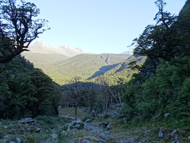
After a few meters the road conditioning ends, and we have to walk on a steep path in the middle of the forest.
The forest is quite dense, and the valley hung quite narrow, so during the way up there was no opportunity to take many photos. However, once we reached the upper part of the valley, the view of Lake Marian between the two granite walls is spectacular.
The way back is done by the same path. Note that the GPX track that I have posted is only one way, if you want to plan this excursion correctly you should multiply the distance as well as the time by two.
Summary:
- Short but beautiful activity on the way to Milford sound. The road from Te-Anau to Milford is full of small activities like this one that we can take advantage of to rest a little after so many hours of driving to get to the fjords.
- The path is fairly easy for fairly experienced hikers, but after rainy days it can be a bit slippery and muddy.
Track Description / Characteristics of the Route:
Distance / Distance: 2.87km (one way)
Elevation Gain / Ascent: 391m
Max / Min Altitude: 751m / 362m
Difficulty / Difficulty: Medium / Medium
Alpine Grade: SD (Without difficulty)
Activity: Hiking / Hiking
Recommended Cartography / Recommended Cartography:
On the way to the Fjord region, on the southern island, on the road from Te-Anau to Milford we can find a lot of wonderful routes that are made in a few hours. A few kilometers before passing the Tunnel of Homer, we stopped to make the route of Lake Marian, a route of one hour (one way) that takes us to a boxed glacial lake carved by the ice between two granitic walls.
The region of the Fjords is a labyrinth of glacial valleys and low mountains, carved by ice for thousands of years, with dense native forests. Wherever you are, you have a beautiful 360 degree view of this great landscape. Threatened bird species such as Kea find in these forests a refuge from their predators.
From the parking we have an hour to get to Lake Marian. The terrain is not very technical, but after rainy days it can be slippery and muddy. It should also be noted that, although it is marked, there are some sections that can be a little confusing, so you have to be attentive all the time to the road markings. As the intuition tells us, the lake is located inside the glacial valley hung in a U-shape, as the image below shows.
The first meters of the route are equipped with wooden walkways so that tourists can see the stream and the waterfalls that form.
After a few meters the road conditioning ends, and we have to walk on a steep path in the middle of the forest.
The forest is quite dense, and the valley hung quite narrow, so during the way up there was no opportunity to take many photos. However, once we reached the upper part of the valley, the view of Lake Marian between the two granite walls is spectacular.
The way back is done by the same path. Note that the GPX track that I have posted is only one way, if you want to plan this excursion correctly you should multiply the distance as well as the time by two.
Summary:
- Short but beautiful activity on the way to Milford sound. The road from Te-Anau to Milford is full of small activities like this one that we can take advantage of to rest a little after so many hours of driving to get to the fjords.
- The path is fairly easy for fairly experienced hikers, but after rainy days it can be a bit slippery and muddy.

Waypoints
 Lake
Lake 0 ft
0 ft
 Car park
You can add a comment or review this trail
Comments