
Key Summit - Fiorland National Park
Trail photos


Author

Trail stats
- Distance
- 2.57 mi
- Elevation gain
- 1,539 ft
- Technical difficulty
- Easy
- Elevation loss
- 69 ft
- Max elevation
- 3,188 ft
- TrailRank
- 31
- Min elevation
- 1,727 ft
- Trail type
- One Way
- Time
- one hour 21 minutes
- Coordinates
- 527
- Uploaded
- January 2, 2016
- Recorded
- November 2015
near Kinloch, Otago (New Zealand)
Viewed 762 times, downloaded 24 times
Trail photos
Itinerary description
Link to the blog post - Link to the blog page
Track Description / Characteristics of the Route:
Distance / Distance: 4.14km
Elevation Gain / Ascent: 456m
Max / Min Altitude: 972m / 526m
Difficulty / Difficulty: Easy / Easy
Alpine Grade: SD (Without difficulty)
Activity: Hiking / Hiking
Recommended Cartography / Recommended Cartography:
Link to GPX track / Link to GPX on Wikiloc

On the way to Fiorland, on the South Island, the road from Te-Anau to Milford is full of wonderful routes that can be done in just a few hours. Near the parking lot of Marian Lake, which we visited on our one-way trip to Milford, we found Key Summit, a modest mountain with beautiful views of the valleys and peaks that surround it.

On one side of the road we find a large parking lot with public services. Parking is usually very popular as it is the beginning / end of the Routerburn track, one of the most famous multi-day hiking activities in New Zealand. The track starts at Glenorchy, where we climbed Mount Alfred a few days ago. From the car park, we follow the route of the Routeburn track about 2.5km. Once at the intersection, the road on the left is the Routeburn track, we stay on the right that ascends to the Key Summit.
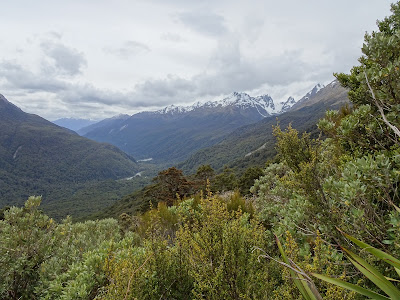
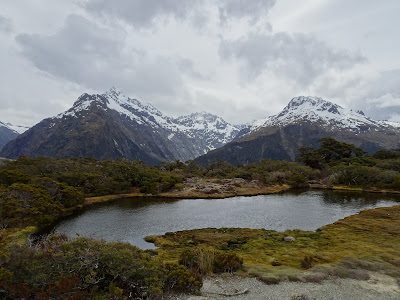
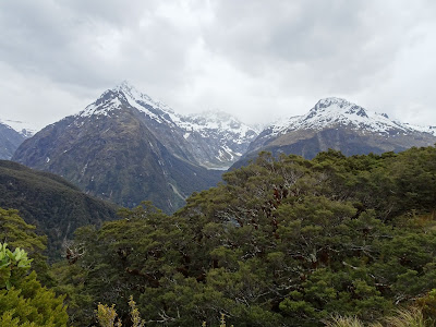
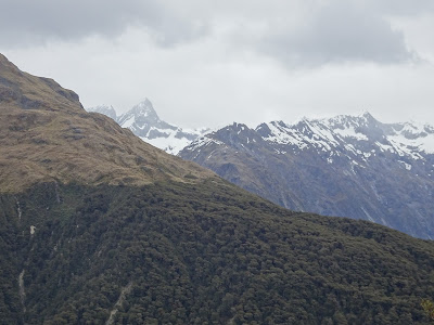
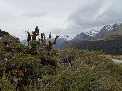
As we climb the slopes of Key summit, the native forest disappears, and we have wonderful views of the valley through which the road that leads to Milford runs.
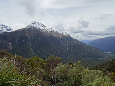
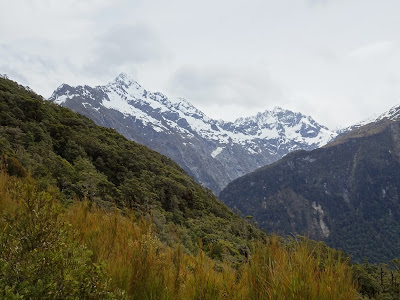
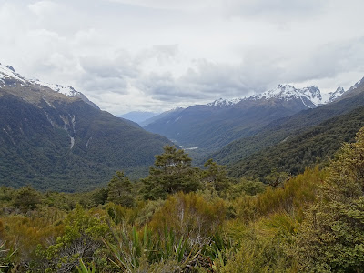
In front of us, the hanging glacial valley where Lake Marian is located, we visited on our way to Milford.
Summary:
- Easy and short activity with wonderful views. It is worth visiting when going to and from Milford Sound.
Track Description / Characteristics of the Route:
Distance / Distance: 4.14km
Elevation Gain / Ascent: 456m
Max / Min Altitude: 972m / 526m
Difficulty / Difficulty: Easy / Easy
Alpine Grade: SD (Without difficulty)
Activity: Hiking / Hiking
Recommended Cartography / Recommended Cartography:
Link to GPX track / Link to GPX on Wikiloc
On the way to Fiorland, on the South Island, the road from Te-Anau to Milford is full of wonderful routes that can be done in just a few hours. Near the parking lot of Marian Lake, which we visited on our one-way trip to Milford, we found Key Summit, a modest mountain with beautiful views of the valleys and peaks that surround it.
On one side of the road we find a large parking lot with public services. Parking is usually very popular as it is the beginning / end of the Routerburn track, one of the most famous multi-day hiking activities in New Zealand. The track starts at Glenorchy, where we climbed Mount Alfred a few days ago. From the car park, we follow the route of the Routeburn track about 2.5km. Once at the intersection, the road on the left is the Routeburn track, we stay on the right that ascends to the Key Summit.
As we climb the slopes of Key summit, the native forest disappears, and we have wonderful views of the valley through which the road that leads to Milford runs.
In front of us, the hanging glacial valley where Lake Marian is located, we visited on our way to Milford.
Summary:
- Easy and short activity with wonderful views. It is worth visiting when going to and from Milford Sound.
Waypoints
 Summit
 0 ft
0 ft

 Car park
You can add a comment or review this trail
Comments