
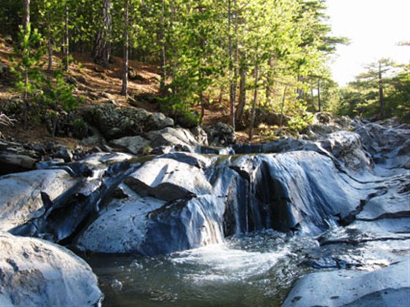
Il torrente Sciambro - The Sciambro stream
Trail photos


Author

Trail stats
- Distance
- 0.48 mi
- Elevation gain
- 0 ft
- Technical difficulty
- Easy
- Elevation loss
- 151 ft
- Max elevation
- 5,475 ft
- TrailRank
-
29
 5
5
- Min elevation
- 5,475 ft
- Trail type
- One Way
- Coordinates
- 147
- Uploaded
- January 29, 2018
- Recorded
- January 2018
near Vena, Sicilia (Italia)
Viewed 1280 times, downloaded 15 times
Trail photos
Itinerary description
3D Video Relive:Il torrente Sciambro, localmente chiamato Quaranta Ore. E' possibile osservarlo soltanto durante brevi periodi durante il disgelo della neve, tipicamente dopo la pioggia.
Per maggiori dettagli, visitate la pagina https://www.etnatracking.com/torrente-sciambro, dove troverete:
-Descrizione dettagliata
-Altre foto
-Informazioni sugli alloggi nei pressi del percorso.
[ENGLISH]
The Sciambro stream, locally know as 40 hours torrent. It is possible to see it only for a while during snow melting season.
More info at https://www.etnatracking.com/en/sciambro-torrent:
-Detailed description
-More Pictures
-Information about accommodations next to the route.
[GERMAN]
Der 'Sciambro' Bach, auch 'Vierzig Stunden' gennant.
Mehr Info: https://www.etnatracking.com/de/der-bach-sciambro:
-Detaillierte Beschreibung
-Mehr Bilder
-Informationen über Unterkünfte neben dem Pfad.

Waypoints
 Waypoint
 5,472 ft
Photo 1
Monte Frumento delle Concazze
 Waypoint
5,472 ft
Waypoint
5,472 ft
Photo 2
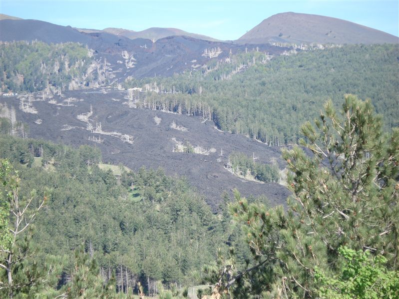
La colata del 2002, con gli alberi "pietrificati"
 Waypoint
5,446 ft
Waypoint
5,446 ft
Photo 3
Il mar Jonio
 Waypoint
5,440 ft
Waypoint
5,440 ft
Photo 4
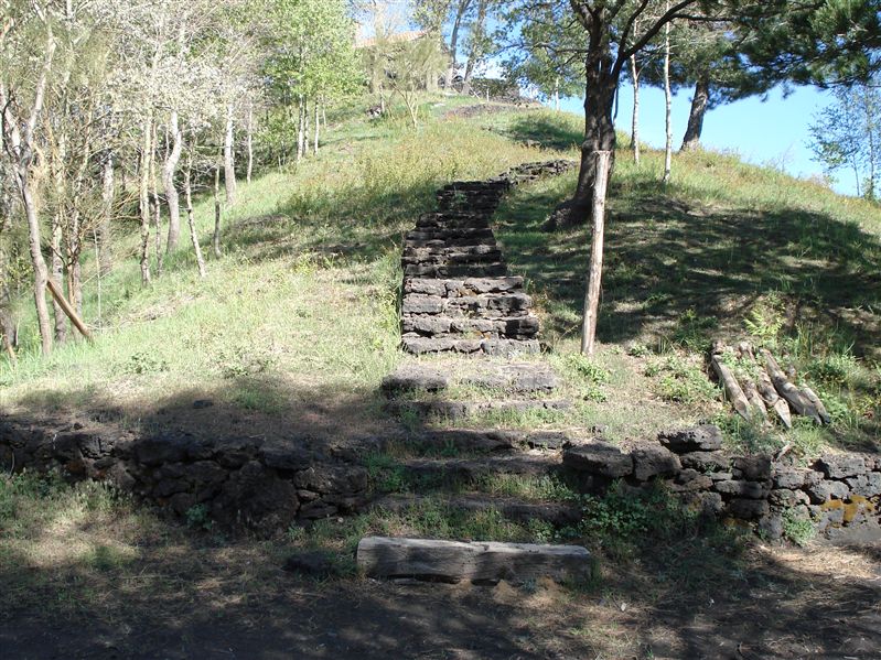
Scalinata verso il punto panoramico
 Waypoint
5,397 ft
Waypoint
5,397 ft
Photo 5
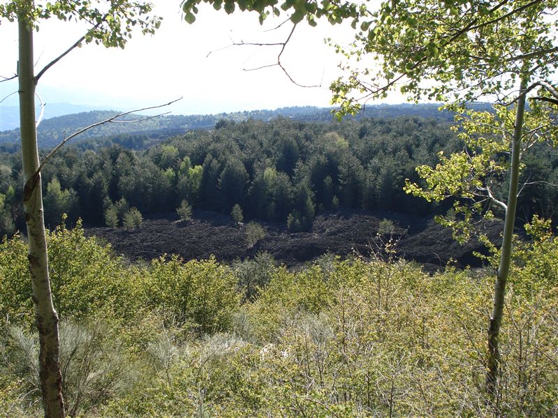
Il ramo di una colata nel bosco
 Waypoint
5,318 ft
Waypoint
5,318 ft
Photo 7
Un bivio: andare a destra
 Waypoint
5,322 ft
Waypoint
5,322 ft
Photo 8
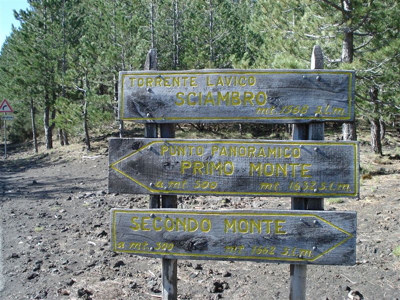
Le indicazioni in strada che indicano il torrente
 Waypoint
5,328 ft
Waypoint
5,328 ft
Photo 9
Una foto del torrente, subito dopo un giorno di pioggia
Comments (1)
You can add a comment or review this trail
I have followed this trail verified View more
Information
Easy to follow
Scenery
Easy
Interesse sentiero sciambro