
Etapa 5. O Camiño dos Faros (Arou-Camariñas)
Author

Trail stats
- Distance
- 14.7 mi
- Elevation gain
- 1,306 ft
- Technical difficulty
- Moderate
- Elevation loss
- 1,368 ft
- Max elevation
- 302 ft
- TrailRank
- 8
- Min elevation
- 4 ft
- Trail type
- One Way
- Time
- 6 hours 42 minutes
- Coordinates
- 2869
- Uploaded
- August 30, 2015
- Recorded
- July 2015
near Arou, Galicia (España)
Viewed 189 times, downloaded 2 times
Waypoints
 Waypoint
 0 ft
0 ft
 Waypoint
0 ft
Waypoint
0 ft
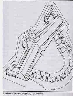
Castelo do Soberano
 Waypoint
0 ft
Waypoint
0 ft
Cementerio dos Ingleses
 Waypoint
0 ft
Waypoint
0 ft
Duna de Monte Branco
 Waypoint
0 ft
Waypoint
0 ft
Enseada de Lucin
Waypoint
0 ft
Enseada de Xan Ferreiro
 Waypoint
0 ft
Waypoint
0 ft
Ermita da Virxe do Monte
 Waypoint
0 ft
Waypoint
0 ft
Faro Vilán
 Waypoint
0 ft
Waypoint
0 ft
Fonte de Arou
Fonte de Arou
Waypoint
0 ft
Monte da Pedrosa
 Waypoint
0 ft
Waypoint
0 ft
 Waypoint
0 ft
Waypoint
0 ft
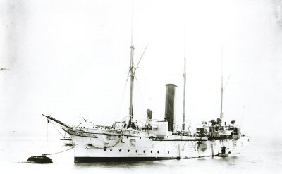
Naufragio Serpent
Waypoint
0 ft
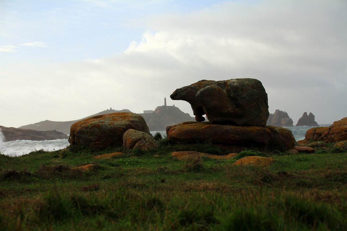
Pedra do Oso
 Waypoint
0 ft
Waypoint
0 ft
Porto de Santa Mariña
 Waypoint
0 ft
Waypoint
0 ft
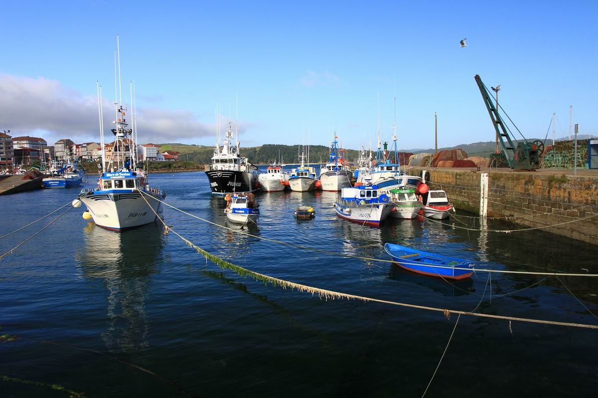
Porto pesqueiro de Camariñas
 Waypoint
0 ft
Waypoint
0 ft
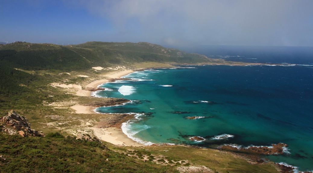
Praia da Pedrosa
Waypoint
0 ft
Praia de Area Longa
 Waypoint
0 ft
Waypoint
0 ft
Praia de Balea
Waypoint
0 ft
Praia de Lobeiras
 Waypoint
0 ft
Waypoint
0 ft
Praia de Reira
 Waypoint
0 ft
Waypoint
0 ft
Praia do Trece
 Waypoint
0 ft
Waypoint
0 ft
Waypoint
0 ft
Waypoint
0 ft
Punta Esperillo

You can add a comment or review this trail
Comments