
CAMINO DE INVIERNO. ETAPA 9 RODEIRO - BERGAZOS (27 km) · 🎥 Vídeo
Trail photos


Author

Trail stats
- Distance
- 17.23 mi
- Elevation gain
- 1,234 ft
- Technical difficulty
- Moderate
- Elevation loss
- 1,696 ft
- Max elevation
- 2,180 ft
- TrailRank
- 39
- Min elevation
- 1,580 ft
- Trail type
- One Way
- Time
- 9 hours 58 minutes
- Coordinates
- 2955
- Uploaded
- January 12, 2018
- Recorded
- August 2017
near Rodeiro, Galicia (España)
Viewed 2771 times, downloaded 45 times
Trail photos
Itinerary description
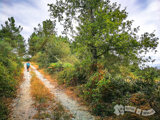
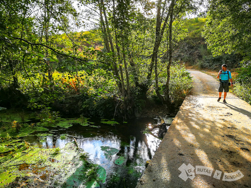
Etapa engañosa en cuanto a perfil, la climatología amenazante la hace un poco más dura pues nos obliga a imprimir un ritmo más acelerado. En cualquier caso nos espera un bonito tránsito por el Condado del Deza, acompañados por el río Arnego durante la primera parte de la etapa hasta el Puente de Pedroso.
Después, nos introduciremos en tierras de Lalín atravesando el monte bajo hasta llegar a la villa. Finalmente, un bello paseo fluvial nos conducirá hasta nuestro destino de hoy. En estas latitudes es famoso el cocido con carne de cerdo...¿seremos capaces de probarlo?
Más información:
- - - - - - - - - - - - - - -- - - - - - - - - - - - - - - -
► SUSCRÍBETE PARA MÁS VÍDEOS
- - - - - - - - - - - - - - -- - - - - - - - - - - - - - - - -
►SÍGUENOS en las REDES SOCIALES:
FACEBOOK
INSTAGRAM
TWITTER
- - - - - - - - - - - - - - -- - - - - - - - - - - - - - - - -
► BLOG
Después, nos introduciremos en tierras de Lalín atravesando el monte bajo hasta llegar a la villa. Finalmente, un bello paseo fluvial nos conducirá hasta nuestro destino de hoy. En estas latitudes es famoso el cocido con carne de cerdo...¿seremos capaces de probarlo?
Más información:
- - - - - - - - - - - - - - -- - - - - - - - - - - - - - - -
► SUSCRÍBETE PARA MÁS VÍDEOS
- - - - - - - - - - - - - - -- - - - - - - - - - - - - - - - -
►SÍGUENOS en las REDES SOCIALES:
- - - - - - - - - - - - - - -- - - - - - - - - - - - - - - - -
► BLOG

Waypoints
 Monument

 Bridge

 Waypoint
 0 ft
0 ft
SENDA
 Waypoint
0 ft
Waypoint
0 ft
PASEO FLUVIAL del RÍO PORTIÑAS
 Waypoint
0 ft
Waypoint
0 ft
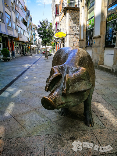
TALLA de CERDO
 Waypoint
0 ft
Waypoint
0 ft
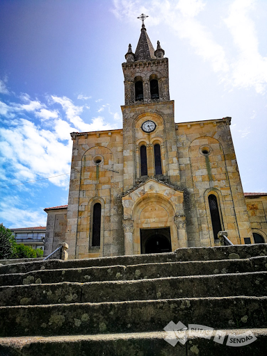
IGLESIA de NUESTRA SEÑORA de los DOLORES
 Religious site
0 ft
Religious site
0 ft
IGLESIA de SAN MARTIÑO
 Waypoint
0 ft
Waypoint
0 ft
CRUCERO SIGLO XVII
 Waypoint
0 ft
Waypoint
0 ft
POR PALMAZ
 Waypoint
0 ft
Waypoint
0 ft
BONITA CAMPIÑA
 Waypoint
0 ft
Waypoint
0 ft
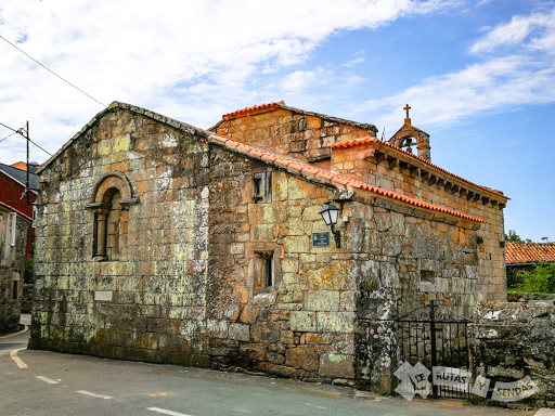
IGLESIA de SAN XIAO de PEDROSO
 Waypoint
0 ft
Waypoint
0 ft
SENDA
 Waypoint
0 ft
Waypoint
0 ft
MAUSOLEO de las 'AGUAS GANADAS'
 Waypoint
0 ft
Waypoint
0 ft
SALVANDO el ARNEGO
 Waypoint
0 ft
Waypoint
0 ft
FLANQUEANDO el ARNEGO
 Waypoint
0 ft
Waypoint
0 ft
PISTA de TIERRA
 Waypoint
0 ft
Waypoint
0 ft
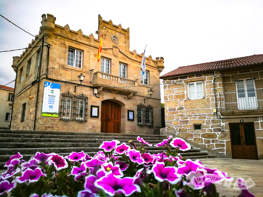
CONCELLO de RODEIRO
You can add a comment or review this trail
Comments