
ANIE-AUÑAMENDI Y PICO ARLAS DESDE PARKING PIERRE SAN MARTIN
Trail photos


Author

Trail stats
- Distance
- 8.17 mi
- Elevation gain
- 3,146 ft
- Technical difficulty
- Easy
- Elevation loss
- 3,146 ft
- Max elevation
- 8,207 ft
- TrailRank
- 53
- Min elevation
- 5,790 ft
- Trail type
- Loop
- Time
- 6 hours 3 minutes
- Coordinates
- 1740
- Uploaded
- August 27, 2019
- Recorded
- August 2019
near Arette-Pierre-Saint-Martin, Nouvelle-Aquitaine (France)
Viewed 1403 times, downloaded 79 times
Trail photos
Itinerary description
Ruta con mucha zona de piedra, para ir atento y no tropezar o torcerte un tobillo.
Posibilidad de subir el pico Arlas, y si no volver por donde se ha subido. Si se hacen las 2, calcular unas 6 horas.
Aunque el día estuvo bastante nublado, las vistas son preciosas.
Subimos desde Isaba hacia Arette y paramos en el parking de La Pierre de Saint Martin.


El primer tramo es precioso, una zona de hierba, pinos y ganado.


Llegamos hasta las faldas del Arlas dejándolo a la izquierda y seguimos el trazado del Anie, es la montaña más grande que tienes en frente.


Hay que intentar no perder de vista las marcas rojas, y más adelante las amarillas. Los hitos también ayudan, pero a veces hay tantos que a veces hasta despistan.

Empieza la zona de piedra, en la que hay largos trazados con rocas grandes, espectacular.


Una vez llegados a las faldas del Anie retomamos el camino marcado por hitos y comenzamos el ascenso que tiene bastantes diagonales y son cómodas.


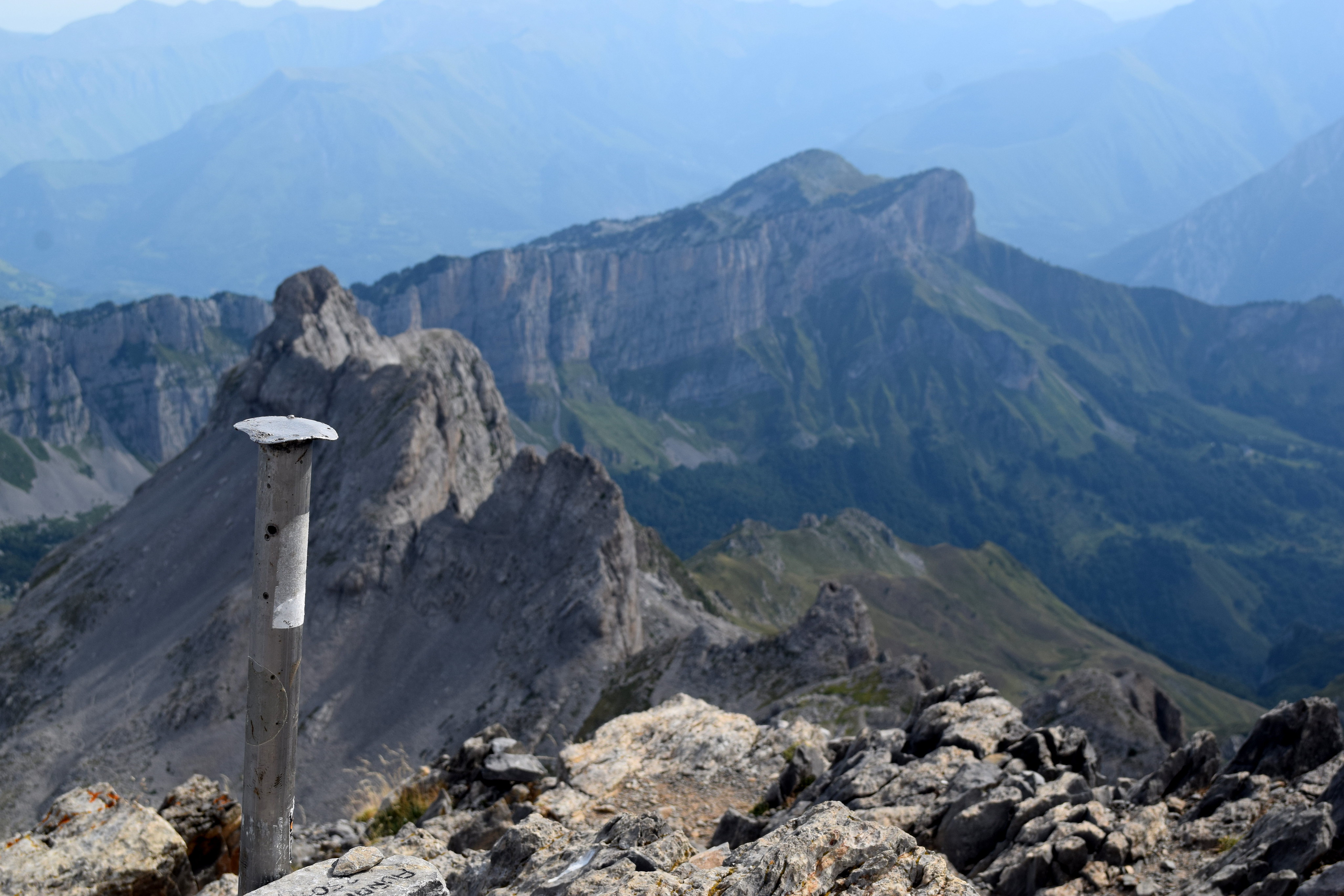
La cima es espectacular.


La bajada de la cima la hicimos con alguna pequeña variante, pero igualmente sin peligro.


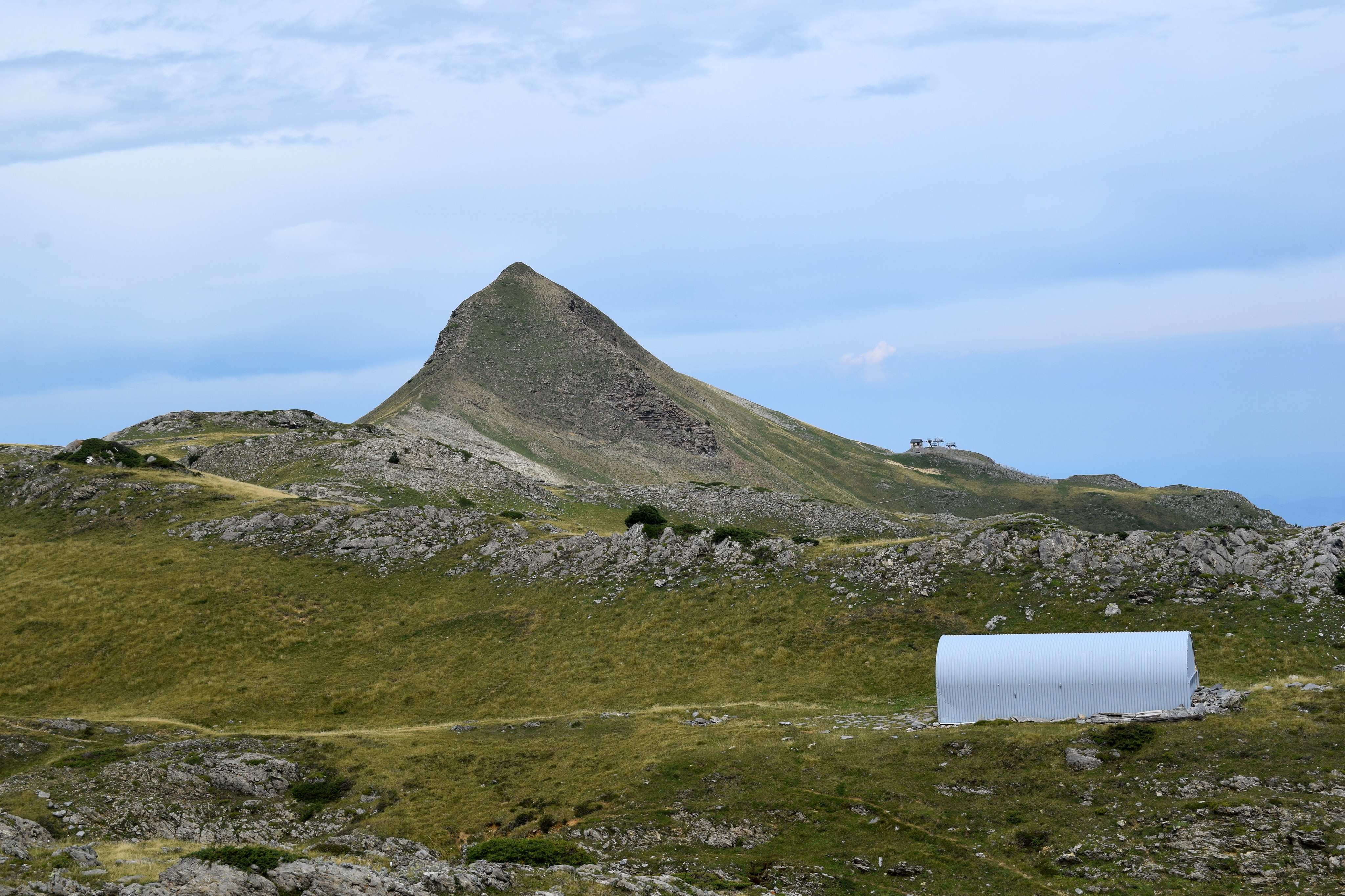
Seguimos el camino hasta llegar a las faldas del Arlas, el cual decidimos ascender por un lado y bajarlo por el otro.
Las vistas del Anie desde el Arlas también muy bonitas.


El último tramo muy cómodo, por pradera de hierba y vistas bonitas.


Y para comer un clásico, la Venta de Juan Pito.
Posibilidad de subir el pico Arlas, y si no volver por donde se ha subido. Si se hacen las 2, calcular unas 6 horas.
Aunque el día estuvo bastante nublado, las vistas son preciosas.
Subimos desde Isaba hacia Arette y paramos en el parking de La Pierre de Saint Martin.
El primer tramo es precioso, una zona de hierba, pinos y ganado.
Llegamos hasta las faldas del Arlas dejándolo a la izquierda y seguimos el trazado del Anie, es la montaña más grande que tienes en frente.
Hay que intentar no perder de vista las marcas rojas, y más adelante las amarillas. Los hitos también ayudan, pero a veces hay tantos que a veces hasta despistan.
Empieza la zona de piedra, en la que hay largos trazados con rocas grandes, espectacular.
Una vez llegados a las faldas del Anie retomamos el camino marcado por hitos y comenzamos el ascenso que tiene bastantes diagonales y son cómodas.
La cima es espectacular.
La bajada de la cima la hicimos con alguna pequeña variante, pero igualmente sin peligro.
Seguimos el camino hasta llegar a las faldas del Arlas, el cual decidimos ascender por un lado y bajarlo por el otro.
Las vistas del Anie desde el Arlas también muy bonitas.
El último tramo muy cómodo, por pradera de hierba y vistas bonitas.
Y para comer un clásico, la Venta de Juan Pito.

Waypoints


 Waypoint
 6,241 ft
05 FUENTE DE LA CONTIENDA
Waypoint
6,304 ft
06 COLLADO PESCAMOU

 Waypoint
7,169 ft
Waypoint
7,169 ft
08 OJO DESVIO


 Waypoint
6,309 ft
Waypoint
6,309 ft
12 COLLADO ARLAS
You can add a comment or review this trail
Comments