
Alella Parc – Dolmen Can Gurri – Dolmen Castellruf – Castellruf – Alella Parc
Trail photos


Author

Trail stats
- Distance
- 3.93 mi
- Elevation gain
- 860 ft
- Technical difficulty
- Easy
- Elevation loss
- 860 ft
- Max elevation
- 1,476 ft
- TrailRank
-
75
 4.8
4.8
- Min elevation
- 1,133 ft
- Trail type
- Loop
- Time
- 2 hours 14 minutes
- Coordinates
- 726
- Uploaded
- January 9, 2019
- Recorded
- December 2018
near Alella, Catalunya (España)
Viewed 1316 times, downloaded 61 times
Trail photos
Itinerary description
INTRODUCCIÓ
He fet aquesta ruta prenent de base el track: Alella-Circuit-Prehistòric del company de Wikiloc Magí Alsina. També és interessant llegir els comentaris fets a la sortida: Serralada de Marina: Dolmens de Can Gurri i Castellruf, Poblat ibèric de Castellruf, 2 fonts, menhir del company de Wikiloc Ambotes. Gràcies per compartir. Molt bones descripcions.
PRINCIPALS ATRACTIUS DE LA SORTIDA
NOTES SOBRE LA SORTIDA
PLÀNOL TOPOGRÀFIC DE LA RUTA

INFORMACIÓ PUNTS SINGULAR (WAYPOINTS)
Altures, desnivells acumulats i temps

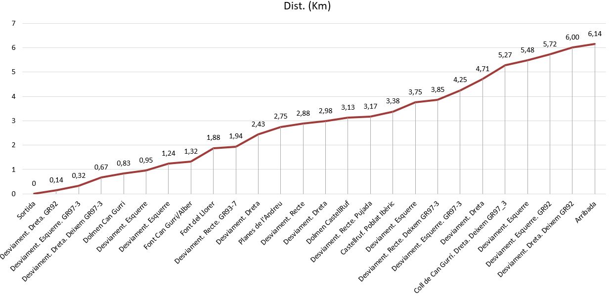
GRÀFICS
Distàncies
Perfil

GRAU DE DIFICULTAT
L'índex de dificultat IBP (veure INDEX IBP) dona un valor de: 29. En podeu veure els detalls a: Anàlisi complet de la ruta
He fet aquesta ruta prenent de base el track: Alella-Circuit-Prehistòric del company de Wikiloc Magí Alsina. També és interessant llegir els comentaris fets a la sortida: Serralada de Marina: Dolmens de Can Gurri i Castellruf, Poblat ibèric de Castellruf, 2 fonts, menhir del company de Wikiloc Ambotes. Gràcies per compartir. Molt bones descripcions.
PRINCIPALS ATRACTIUS DE LA SORTIDA
- Dòlmens prehistòrics i poblat ibèric.
- Dues fonts.
- Passejar per bosc de secà amb fondalades de gran vegetació.
- Bones vistes.
NOTES SOBRE LA SORTIDA
- Deixem el cotxe a la part alta de Alella Parc. Carrer Salvador Espriu davant del número 30.
- Passem per camins amples i corriols ben fressat. Anem alternant els GR92 i GR97-3.
- Hi ha moltes desviacions, recomano la utilització de GPS. Aneu amb compte en el WP, desviament a l’esquerre, després de Coll de Can Gurri, perquè es passa d’un camí ample a un corriol i pot quedar desapercebut.
PLÀNOL TOPOGRÀFIC DE LA RUTA
INFORMACIÓ PUNTS SINGULAR (WAYPOINTS)
Altures, desnivells acumulats i temps
GRÀFICS
Distàncies
Perfil
GRAU DE DIFICULTAT
L'índex de dificultat IBP (veure INDEX IBP) dona un valor de: 29. En podeu veure els detalls a: Anàlisi complet de la ruta
Waypoints
 Waypoint


 Archaeological site


 Fountain


 Intersection
 1,346 ft
Desviament. Recte


 Mountain pass
 Intersection
1,301 ft
Intersection
1,301 ft


Desviament. Esquerre
Anar amb compte en aquest punt, perquè es passa d'un camí ample a un corriol i aquest pot quedar desapercebut.


Comments (11)
You can add a comment or review this trail
I have followed this trail verified View more
Information
Easy to follow
Scenery
Easy
Una ruta muy simpática e interesante para hacerla con niños por el tema de los dólmens.
Gracias por tu valotación i comentarios. Totamente de acuerdo contigo: un agradable y instructivo paseo. Salut i Cames!!!!
I have followed this trail View more
Information
Easy to follow
Scenery
Easy
Ruta molt ben indicada, amb moltes indicacions de punts d’interès.
Travesa, moltes gràcies per la teva valoració i comentaris positius. Ruta assequible amb bones vistes i punts interessants. Salut i Cames!!!!
I have followed this trail View more
Information
Easy to follow
Scenery
Easy
M'ha agradat molt. Hem pogut seguir la ruta molt bé.
I have followed this trail View more
Information
Easy to follow
Scenery
Easy
Ruta molt ben indicada i agradable de fer. Gràcies
Moltes gràcies per la teva valoració i comentaris. M'agrada que l'hagis gaudida. Salut i Cames!!!!
I have followed this trail verified View more
Information
Easy to follow
Scenery
Easy
Ruta molt agradable i amena. Hem fet una variant evitant el sender entre la font d'en Gurri i la font del llorer i continuant per pista fins a la font de la mercè.
David_JL gràcies per la teva valoració i comentaris. La fam trobar assequible i entretinguda. Salut i Cames!!!!
I have followed this trail verified View more
Information
Easy to follow
Scenery
Easy
Bona ruta i bones vistes! Algun curt tram lleugerament relliscós, la resta fàcil
Gràcies per la teva valoració i comentaris. Els camins canvien i qualsevol indicació recent és important per a qui es prepara per fer aquesta sortida. Salut i Cames!!!!