
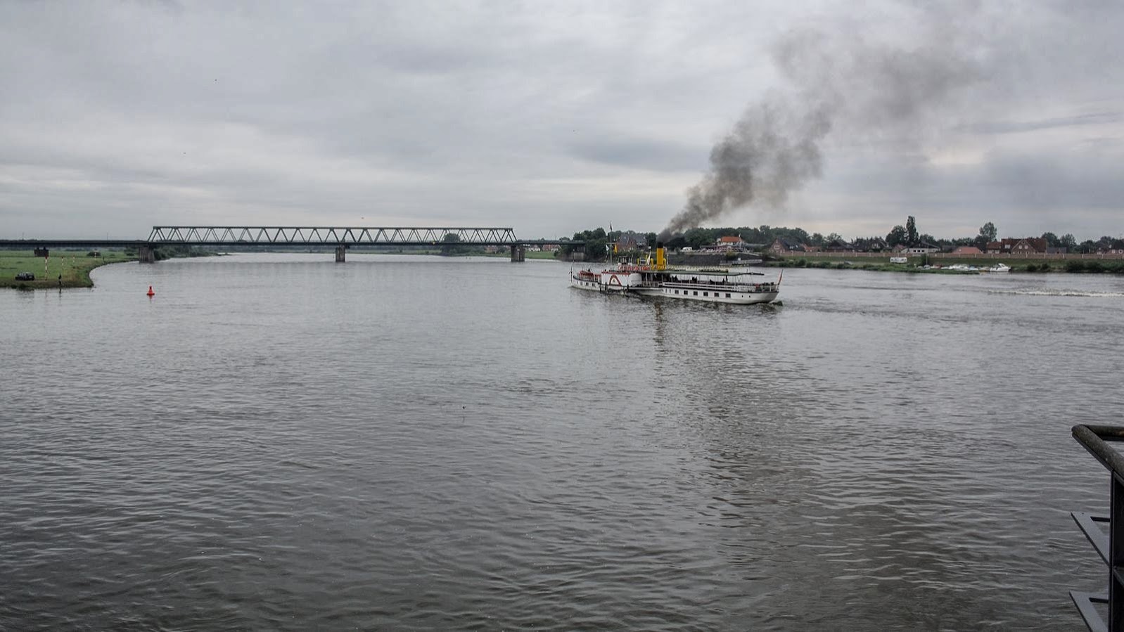
WCRVBB-21-ELBERADWEG - STAGE 03 - Hamburg-Hitzacker 113 km
Trail photos


Author

Trail stats
- Distance
- 70.51 mi
- Elevation gain
- 1,083 ft
- Technical difficulty
- Moderate
- Elevation loss
- 1,066 ft
- Max elevation
- 262 ft
- TrailRank
- 40
- Min elevation
- 0 ft
- Trail type
- One Way
- Coordinates
- 3987
- Uploaded
- October 6, 2013
- Recorded
- October 2013
near St. Pauli, Hamburg (Deutschland)
Viewed 5112 times, downloaded 39 times
Trail photos
Itinerary description
| <<<Click for previous stage<<< | Click for entire route | >>>Click for next stage>>> |
| Click for the other WCRVBB routes | ||
WCRVBB-21-ELBERADWEG - STAGE 03 - Hamburg-Hitzacker 113 km
Esta tercera estapa nos lleva de Hamburgo a Hitzacker, bella ciudad a orillas de río Elba y con un complejo sistema de muros para evitar los embites de las crecidas del río. La etapa es llana y sin dificultades.
La salida de Hamburgo es fácil y discorre por caminos asfaltados lejos del río hasta Geestach. A partir de ahí pasamos por un bosque frondoso con algunas subidas y llegamos a la bella ciudad de Lauenburg.
El resto son carriles bicis y carreteras locales a cierta distancia del río hasta Hitzacker
STAGE DESCRIPTION
After the lively night at Hamburg, we leave he city by easytoride bike lines that leds you out. Before, the track does some visits to the city, like the harbour, the chanels of the center, the Town Hall (Rathaus). We reach the central lake (Binnenalster) with its big fountain in the middle.

Then we visit Alster, the biggest lake with many parks around. After that we head outside the city, to pass the artificial Island with a Industrial Museum inside. The first km of the stage passe through paved paths far from the river, till we reach Neuengamme Concentration Memorial Camp.
It have many tombs amb monuments and you can visit exhibitions about WWII.

Few quilometers away, we reach the city of Geestacht, where you can visit Saint Salvatorius Church. After that you pass next to a nuclear power station, and an Energy park, with examples of diferents sources of energy (hidroelectric, windmills, ...). We are cycling now next to the river.
After that, we enter a very leafy forest with high trees. It's a bit hilly but the landscape and the path is very funny and beautiful.

Just outside the forest we reach the beautiful city of Lauenburg, which has a very interesting street paralel to the river, fully of marvellouse houses made of bricks. You can also go uphill to a park with excellents views to the river. Next to the river, there is an interesting restaurant where
you can take a rest and enjoy the magnifient views of the river and listen the explanations of the waiters of where the level of the water reached just in june 2013 floods.
Next to Lauenburg we cross the river once more, to the left bank, using a bridge with bike line beside. Then you ride to Bleckede following some local paved roads with no traffic or other bigger roads with traffic but with a bike line separated. Here you can take a rest
and visit the castle with excellent views and an exhibition about the biosphere.
The rest of the stage is a bit hilly, using local road with no traffic and some attractions as some windmills and a water mill in Ner Dachau.

Finally we reach Hitzckaer.
POINTS OF INTEREST
- Neuangamme Memorial Concentration Camp, where you can visit some monuments and exhibitions about WWII.
- Geesthath and its Sain Salvatorius Church.
- Energy park with hidroelectric centrals, nuclear power utilities, windmills, pumping stations, ...
- Lauenburg and his beautiful old center next to the river and up the hill.
- Blechede and his castle, hight tower with excellent views and Biosphere exhibitions.
- Some view towers and a water mill.
DESTINATION POINT
Hitzacker is a very beautiful village next to the river. With a complex system to avoid the floods of the river, it has also a excellen terrace with magnificient views on the river. The church and some interesting streets with tradicional houses, makes the village charming to walk up and down.
There are many restaurants and hotels to make the rest of the stage. We spend in a bed and breakfast, but there are also some small hotels to choose.

ALTERNATIVE ROUTES
There is a road to avoid the non paved and hilly path over the forest. After Lauenburg you can also decide no to change the bank of the river and follow the left one till Hitzacker, where you take a ferry to reach the city.
| <<<Click for previous stage<<< | Click for entire route | >>>Click for next stage>>> |
Podeu contactar amb vicens.borrell@gmail.com per mes informació.
You can contact with vicens.borrell@gmail.com for further information.
You can find the other world cycling routes of the WCRVBB project clicking here to access.
You can click over this other project bike routes or search the tags in google.
- DCRVBB, for one day routes around Europe.
- KCRVBB, for one day routes with kids around Europe.
- COLVBB, for climbings of Tour de France, Vuelta a Espanya, Giro di Italia, ...
- BCNVBB, for one day routes around Barcelona.
- RBTTCASSA, for MTB routes around Cassa de la Selva (Girona).
- RBTTCAT, for MTB routes around Catalunya.
Have a nice trip!

Waypoints
 Waypoint
 0 ft
0 ft
Wooden bridge
Wooden bridge
Waypoint
0 ft
Toll House museum
Toll House museum
Waypoint
0 ft
Historic center with beautiful houses
Historic center with beautiful houses
 Photo
Photo Waypoint
0 ft
Waypoint
0 ft
Little harbour and quay
Little harbour and quay
Waypoint
0 ft
Viewing tower
Viewing tower
Waypoint
0 ft
Point of View
Point of View
Waypoint
0 ft
Saint Johns Kirche
Saint Johns Kirche
Waypoint
0 ft
Ancient big chesnut tree
Ancient big chesnut tree
Waypoint
0 ft
Vineyard very north in Germany
Vineyard very north in Germany
Waypoint
0 ft
Dam for inundations
Dam for inundations
Waypoint
0 ft
Pumping station
Pumping station
Waypoint
0 ft
Fish Sculpture
Fish Sculpture
Waypoint
0 ft
The oldest Inn in Hitzacker
The oldest Inn in Hitzacker
Waypoint
0 ft
Archeological center
Archeological center
Waypoint
0 ft
E03A1-2 km-Directe
E03A1-2 km-Directe
Waypoint
0 ft
Industrial Museum and Artificial Island
Waypoint
0 ft
Border Tower
Border Tower
Waypoint
0 ft
Sant Nicolai Church, cementery and house
Sant Nicolai Church, cementery and house
Waypoint
0 ft
St. Salvatorius Church
St. Salvatorius Church
Waypoint
0 ft
Museum Elbe River Ship 10-17 1 euros
Museum Elbe River Ship 10-17 1 euros
Waypoint
0 ft
Elbe Biosphere Information Center
Elbe Biosphere Information Center
Waypoint
0 ft
Pintoresque Village of Bleckede
Pintoresque Village of Bleckede
Waypoint
0 ft
Starting Elbe Border
Starting Elbe Border
Waypoint
0 ft
Viewing Tower
Viewing Tower
Waypoint
0 ft
Water Mill
Water Mill
Waypoint
0 ft
Viewing Tower
Viewing Tower
Waypoint
0 ft
Palace Tower
Palace Tower
Waypoint
0 ft
Kirche Saint Magdalene
Kirche Saint Magdalene
Waypoint
0 ft
Lauenburg old street
Lauenburg old street
Waypoint
0 ft
Ferry factory
Ferry factory
Waypoint
0 ft
Park with views (Fustengarten)
Park with views (Fustengarten)
Waypoint
0 ft
Kanal Elbe-Lubek (Baltic Sea)
Kanal Elbe-Lubek (Baltic Sea)
Waypoint
0 ft
Nuclear Utility with big wall photo
Nuclear Utility with big wall photo
Waypoint
0 ft
Energy park and Francis Turbine (solar, wind, water)
Energy park and Francis Turbine (solar, wind, water)
 Castle
 Waypoint
0 ft
Waypoint
0 ft
Fish Farm
Fish Farm
Waypoint
0 ft
Schillers Gasthaus
Schillers Gasthaus
You can add a comment or review this trail
Comments