
WCRVBB-21-ELBERADWEG - STAGE 02 - Oederquart-Hamburg 90 km
Trail photos


Author

Trail stats
- Distance
- 56.51 mi
- Elevation gain
- 177 ft
- Technical difficulty
- Moderate
- Elevation loss
- 194 ft
- Max elevation
- -1 ft
- TrailRank
- 40
- Min elevation
- -73 ft
- Trail type
- One Way
- Coordinates
- 2860
- Uploaded
- October 6, 2013
- Recorded
- October 2013
near Oederquart, Niedersachsen (Deutschland)
Viewed 4444 times, downloaded 16 times
Trail photos
Itinerary description
| <<<Click for previous stage<<< | Click for entire route | >>>Click for next stage>>> |
| Click for the other WCRVBB routes | ||
WCRVBB-21-ELBERADWEG - STAGE 02 - Oederquart-Hamburg 90 km
La segunda etapa, es la primera completa y sirve para llegar a Hamburgo, un puerto fluvial muy importante. Es muy plana y fácil con muchos caminos pavimentados cerca del dique de contención. La parte más interesante es la incursión en el canal de Stade. Después de muchos km, cerca del río
la ruta tiene un canal con un camino muy estrecho en la presa que es muy divertido. El pavimento no es tan bueno, pero es muy bonito y se pasa cerca de las casas que están al lado del dique.
Stade es muy bonito y un buen descanso en el medio en el resto. Volviendo al río, después de cruzar un aeropuerto, se llega a la parada del autobús-barco. Una manera divertida y práctica para llegar al centro de Hamburgo.
STAGE DESCRIPTION
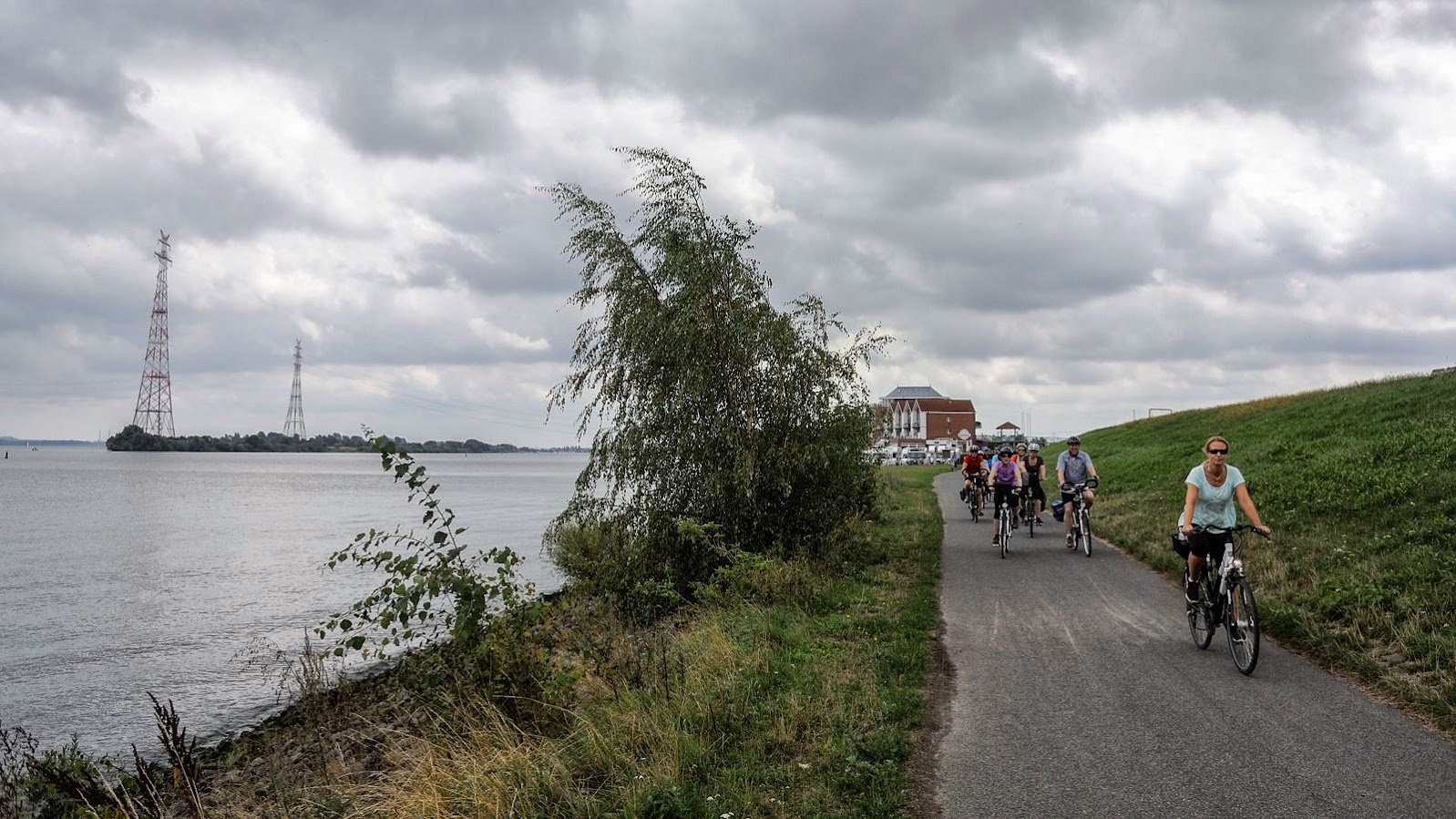
After a full breakfast in the hotel, the path starts on local roads with few traffic, sometimes with paved cycle paths next to the road.

After a few km, we reach another time the river and we ride on paved paths outside the dam. Sometimes we can reach the river and
see the sandy beaches with many fishers and swimmers. Tides are interesting to see also at this point.
After serveral kilometers next to the river, and leaving an interesting area with fast-food restaurants near a parking in the river, we take a chanel that leads to Stade. Riding this way, we find a narrow path on the dam, which is not so good to ride but ver funny. You pass between beautiful houses,
some cafes next to the dam and many curves that makes an amazing ride.

The arrival to Stade is very impressive, with some centric and touristic streets that are pedestrian and you have to go down the bike. But all the brick walls of the houses and the services of the town, gives the city an interesting feeling. The most beautiful part is the center with a chanel and a market
next to it. There are museums and an interesting church.

After Stade you follow the chanel and rides through Jork, an interesting city with many services and a windmill as a main atraction. You join once more the big river, with paths next to the dam, before reaching an airport and the main road with a paved cycle path next to it.

Then you reach the left bank of the river in Hamburg, and finally the bus-boat stop. There are many frequent buses to the center. It's cheap, easy for the bikes and a fast way to get to the center of Hamburg and avoid traffic to get inside the city.

POINTS OF INTEREST
- Grauferort fortress. The path pass next to the walls.
- City of Stade and its chanels. Interesting church.
- Jork. Rathaus, Windmill and Church with wooden roof.
DESTINATION POINT
Hamburg is a very vively city. Reeperbhan street is very amusing specially at night. Hamburg is the capital of the sex (similar to Amsterdam). It's interesting also to see the harbour, with meny restaurants and many sailor ships to visit. The monumental part is around the central lake and its chanels. It's central
square, next to the Rathaus is the very center of the cities. There are also many parks in the city.

Once in Hamburg you have many choices to take a rest. Our Hostel/Hotel in Repeherban Street (Aorephba) was a cheap and correct place to spend the night.
ALTERNATIVE ROUTES
You have the choice to shorten the route not entereing to Stade, so you follow straigt ahead next to the river.
| <<<Click for previous stage<<< | Click for entire route | >>>Click for next stage>>> |
Podeu contactar amb vicens.borrell@gmail.com per mes informació.
You can contact with vicens.borrell@gmail.com for further information.
You can find the other world cycling routes of the WCRVBB project clicking here to access.
You can click over this other project bike routes or search the tags in google.
- DCRVBB, for one day routes around Europe.
- KCRVBB, for one day routes with kids around Europe.
- COLVBB, for climbings of Tour de France, Vuelta a Espanya, Giro di Italia, ...
- BCNVBB, for one day routes around Barcelona.
- RBTTCASSA, for MTB routes around Cassa de la Selva (Girona).
- RBTTCAT, for MTB routes around Catalunya.
Have a nice trip!

Waypoints
 Waypoint
 0 ft
0 ft
E02A1-5km-No Stade
E02A1-5km-No Stade
Waypoint
0 ft
E02A2-5km-Directe Jork
E02A2-5km-Directe Jork
Waypoint
0 ft
E02A3-3km-Directe embarcador
E02A3-3km-Directe embarcador
 River
River Waypoint
0 ft
Waypoint
0 ft
Jork - Kirchen with wooden clock tower
Jork - Kirchen with wooden clock tower
 Ruins
Ruins
 Lake
Lake Waypoint
0 ft
Waypoint
0 ft
Jork Rathaus
Jork Rathaus
Waypoint
0 ft
Windmill Ventiamica
Windmill Ventiamica
 Photo
Photo Waypoint
0 ft
Waypoint
0 ft
Saint Cosmae Church Stade
Saint Cosmae Church Stade
Waypoint
0 ft
Saint Johammes Monastery
Saint Johammes Monastery
Waypoint
0 ft
Grauerort Fortress
Grauerort Fortress
 Wilderness hut
0 ft
Wilderness hut
0 ft

AO Reeperbahn Street
http://www.aohostels.com/en/hamburg/hamburg-reeperbahn/#&slider1=2
Waypoint
0 ft
Kramer Widows Apartments (Narrow street)
Kramer Widows Apartments (Narrow street)
Waypoint
0 ft
Dockland (Mall in red bricks)
Dockland (Mall in red bricks)
Waypoint
0 ft
Saint Michelis church (climb on the top)09-20:00 5 euros Torre
Saint Michelis church (climb on the top)09-20:00 5 euros Torre
Waypoint
0 ft
Plantam un Bomen (Japanese style garden)
Plantam un Bomen (Japanese style garden)
Waypoint
0 ft
Hamburg Rathaus
Hamburg Rathaus
Waypoint
0 ft
Alter Elbe Park
Alter Elbe Park
Waypoint
0 ft
Reeperbahn Street
Reeperbahn Street
Waypoint
0 ft
Elbe Tunnel Lift
Elbe Tunnel Lift
You can add a comment or review this trail
Comments