
Alternate Route Around Deer Lake 6 km
Author

Trail stats
- Distance
- 4.09 mi
- Elevation gain
- 138 ft
- Technical difficulty
- Easy
- Elevation loss
- 98 ft
- Max elevation
- 124 ft
- TrailRank
- 9
- Min elevation
- 33 ft
- Trail type
- One Way
- Coordinates
- 58
- Uploaded
- April 30, 2019
- Recorded
- April 2019
near Deer Lake, Newfoundland (Canada)
Viewed 47 times, downloaded 0 times
Itinerary description
You can take this route to avoid the overpass going over the Trans Canada. Still required paved road driving.
Waypoints
 Waypoint
 37 ft
37 ft
Cliffside Cabins
https://www.facebook.com/WendysCliffsideCottage/?fref=ts
They have two cabins. A big one and a smaller one.
Small cabin - 1 bedroom with a Queen bed, and a double pull-out sofa.
Large Cabin - 1 bedroom with King bed, a loft with a single bed and a double pull-out sofa.
48.2502, -58.817
Waypoint
52 ft
Riverwood Cottages
http://riverwoodcottages.ca/
48.24067, -58.81157
Waypoint
978 ft
Lookout Point

 Waypoint
44 ft
Waypoint
44 ft
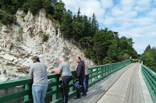
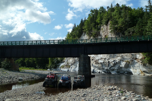
Fishell's Bridge
Nice spot to stop and take pictures of gypsum rock wall 48.30686, -58.67969
 Waypoint
555 ft
Waypoint
555 ft
Abandoned Campground Stag Lake
Waypoint
40 ft
Rapid Power Sports
Can Am and Kawasaki Dealer
You can add a comment or review this trail
Comments